
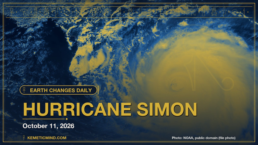
Earth Changes · Daily Report · October 11, 2026, 6:30 AM CDT
Hurricane Simon is churning in the eastern Pacific with top winds near 155 mph and a central pressure of 930 millibars, moving north-northwest at 6 mph, according to the National Hurricane Center.[1] It is one of 3 tropical systems the center is tracking, along with Potential Tropical Cyclone Rachel and Potential Tropical Cyclone Isaias.
Meanwhile, the National Weather Service has 70 severe or extreme alerts in effect, led by 20 flood warnings across AL, FL, GA, IA and more.[2]
Elsewhere, GDACS, the UN-backed global disaster alert system, issued a Orange alert: Orange earthquake (Magnitude 7.7M, Depth:12.647km) in Panama 09/10/2026 17:56 UTC, 540 thousand (in MMI>=VII)..[3]
Today at a Glance
- 20 earthquakes of magnitude 4.5 or greater, the largest M5.3
- 3 active tropical systems: Hurricane Simon, Potential Tropical Cyclone Rachel, Potential Tropical Cyclone Isaias
- 70 severe or extreme U.S. weather alerts
- 4 U.S. volcanoes above normal, including Great Sitkin, Kilauea
- 3 sinkhole reports in the news
Could not be reached for this edition: Smithsonian weekly volcano report.
Where It’s Happening
Numbered pins match the list under the map. Storm and quake pins are the agencies' reported centers; sinkhole pins mark the town named in the report. Map data: OpenStreetMap contributors.
1. Extreme Weather
Tropical storms and hurricanes
- Hurricane Simon (eastern Pacific): top winds near 155 mph, moving north-northwest at 6 mph. Latest advisory.[1]
- Potential Tropical Cyclone Rachel (eastern Pacific): top winds near 50 mph, moving north at 25 mph. Latest advisory.[1]
- Potential Tropical Cyclone Isaias (Atlantic): top winds near 25 mph, moving northeast at 23 mph. Latest advisory.[1]
Across the United States, the National Weather Service has 70 alerts rated severe or extreme in effect.[2]
| Alert | Number | States |
|---|---|---|
| Flood Warning | 20 | AL, FL, GA, IA, LA, NC and more |
| Flood Watch | 13 | AZ, CA, GA, ID, NC, NV and more |
| Winter Storm Warning | 10 | AK, MT |
| Flash Flood Warning | 9 | AZ, CA, NC, SC, VA |
| Freeze Warning | 6 | CA, ME, OR, WA |
| Coastal Flood Warning | 3 | CA |
| High Wind Warning | 3 | AZ, CA, NV, UT |
| High Wind Watch | 2 | WY |
| Red Flag Warning | 2 | CA, MI |
| Freeze Watch | 1 | WA |
The Storm Prediction Center says its highest risk level for severe thunderstorms today is slight, on a scale that runs marginal, slight, enhanced, moderate, high.[4]
Around the world, GDACS, the global disaster alert system run by the United Nations and the European Commission, lists these Orange or Red alerts from the past two days:
- Orange: Orange earthquake (Magnitude 7.7M, Depth:12.647km) in Panama 09/10/2026 17:56 UTC, 540 thousand (in MMI>=VII).[3]
Video: Associated Press, October 11, 2026 — “Hurricane Simon reaches Category 4 as Mexico's Puerto Vallarta prepares for landfall”. Matched to this report by the storm, volcano or place name in its title.
Video: ABC News, October 10, 2026 — “Coastal floods rise as Tropical Storm Rachel impacts California”.
2. Earthquakes
The USGS recorded 20 earthquakes of magnitude 4.5 or greater in the past 24 hours.[5] The strongest:
| Mag. | Where | When | Depth | PAGER |
|---|---|---|---|---|
| 5.3 | southeast of Easter Island | Oct. 10, 9:34 p.m. UTC | 10 km | — |
| 5.2 | 180 km S of Pelabuhanratu, Indonesia | Oct. 11, 3:30 a.m. UTC | 10 km | — |
| 5.0 | 3 km NW of Flores, Panama | Oct. 11, 1:50 a.m. UTC | 10 km | — |
| 4.9 | Kermadec Islands region | Oct. 10, 8:35 p.m. UTC | 118 km | — |
| 4.8 | 11 km SSW of Tebario, Panama | Oct. 10, 3:58 p.m. UTC | 10 km | — |
| 4.8 | 12 km NE of La Tronosa, Panama | Oct. 10, 1:46 p.m. UTC | 10 km | — |
| 4.7 | 110 km SSE of Sola, Vanuatu | Oct. 11, 5:07 a.m. UTC | 11 km | — |
| 4.7 | 2 km WNW of El Cacao, Panama | Oct. 10, 4:05 p.m. UTC | 14 km | — |
PAGER is the USGS estimate of likely deaths and damage: GREEN means little or none expected, RED means extensive. A dash means none was issued.
Video: Associated Press, October 11, 2026 — “Panama declares state of emergency after 7.7 and 6.6 magnitude earthquakes”.
3. Volcanoes
In the United States, 4 volcanoes are above normal background activity, according to the U.S. Geological Survey’s observatories:
| Volcano | Alert / aviation code | Latest word from scientists |
|---|---|---|
| Great Sitkin | Watch / Orange | Slow eruption of lava within the summit crater continues.[6] |
| Kilauea | Watch / Orange | Kīlauea summit north vent erupted minor spatter overnight. Kīlauea summit is at a high level of pressurization. Fountaining, intrusions, or an eruption in a new location within the summit region could occur in the coming days to weeks.[7] |
| Ahyi Seamount | Advisory / Yellow | No plumes seen in satellite images; no significant geophysical signals.[8] |
| Shishaldin | Advisory / Yellow | Low-level unrest continues.[6] |
Alert levels run Normal, Advisory, Watch, Warning. Aviation codes run Green, Yellow, Orange, Red.
4. Sinkholes
No government agency publishes a live national sinkhole feed, so these come from today’s local news:
- Gua Musang, Malaysia: Yahoo reports, “Public Works Dept to install Bailey bridge after sinkhole closes Gua Musang-Kota Bharu road KUALA LUMPUR, Oct 11 — The Public Works Department (JKR) will install a Bailey bridge to restore access along the Gua Musang-Kota Bharu road (FT08), which was fully closed following a sinkhole near the Kesedar Ethnobotanical Recreation Park in Gua Musang, Kelantan, yesterday.”[9]
- L'Unione Sarda.it reports, “The road suddenly opens, car sinks into the sinkhole Extensive damage and fears after torrential rains hit the province of Reggio Calabria.”[10]
- PUNE PULSE reports, “Chennai Road Collapses Near Metro Site, SUV Swallowed By 10 Feet Sinkhole A car overturned into a 10 feet crater on Old Mahabalipuram Road near Tidel Park, leaving two occupants unharmed and causing major traffic disruption.”[11]
Also in the News
Other natural-hazard video from the past day, from news organizations:
Video: BBC News, October 11, 2026 — “Four dead and thousands without power after Hurricane Isaias lashes US. #BBCNews”. Also in the news. Picked because its title names a natural hazard; it may not be covered in the data above.
Video: Al Jazeera English, October 11, 2026 — “Flash flood sweeps away buildings in Nepal | AJ #shorts”. Also in the news.
5. What the Experts Say
These are the words of the scientists and forecasters who watch these hazards for a living, quoted exactly.
“The Air Force Reserve Hurricane Hunters provided some valuable information on the structure of Simon overnight. They found that the pressure had dropped to 928 mb, with maximum flight-level winds of 135 kt within the small inner core. Similar to the afternoon flight, the whole wind field could not be observed. The initial intensity is kept at 135 kt for this advisory as a blend of the flight-level wind data, assuming a larger undersampling factor than normal, with a slight weight on earlier experimental Synthetic Aperture Radar (SAR) data, which showed category 5 strength.”
— Forecaster Blake, National Hurricane Center, on Hurricane Simon[12]
“Post-Tropical Cyclone Rachel Discussion Number 57 NWS National Hurricane Center Miami FL EP182026 200 AM PDT Sun Oct 11 2026”
— Forecaster Katz/Blake, National Hurricane Center, on Potential Tropical Cyclone Rachel[13]
“Thunderstorms capable of producing isolated severe wind gusts and a tornado or two will be possible today across parts of the Mid-Atlantic. Additional storms with isolated severe gusts will be possible in parts of the Desert Southwest and Four Corners region.”
— NOAA Storm Prediction Center[4]
“Lava continues to erupt slowly within the summit crater of Great Sitkin Volcano. Minor earthquakes were detected in the past day. No activity was observed in cloudy webcam and satellite images over the past day.”
— Alaska Volcano Observatory, on Great Sitkin[6]
“Both the north and south vents in Halemaʻumaʻu showed strong glow and flames in overnight webcam imagery, with minor amounts of spatter erupted by the north vent. Several small overflows at the base of north vent were observerd over the past day. Robust plumes of volcanic gas emanate from both vents in day-time webcam views.”
— Hawaiian Volcano Observatory, on Kilauea[7]
“Sinkholes are common where the rock below the land surface is limestone, carbonate rock, salt beds, or other rocks that can naturally be dissolved by groundwater circulating through them. As the rock dissolves, spaces and caverns develop underground. Sinkholes are dramatic because the land usually stays intact for a while until the underground spaces just get too big.”
— U.S. Geological Survey Water Science School, on why sinkholes form[14]
How to Prepare
- Keep a basic kit: water (one gallon per person per day for several days), food, a battery or hand-crank radio, a whistle, a dust mask and phone chargers.[15]
- Get alerts: Wireless Emergency Alerts need no sign-up; the FEMA app, NOAA Weather Radio, the USGS Earthquake Notification Service and the USGS Volcano Notification Service are free.
- Floods: Turn Around, Don’t Drown. Six inches of moving water can knock you down, and one foot can sweep a car away.[16]
- Earthquakes: Drop, Cover and Hold On.[17]
- Download the checklist: Be Ready: Earthquakes, Volcanoes, Extreme Weather and Sinkholes (PDF), with today’s active hazards first.
How to Verify This Yourself
- Earthquakes: USGS Latest Earthquakes map
- U.S. volcanoes: USGS Volcano Hazards Program; world: Smithsonian weekly report
- Weather alerts: weather.gov; tropics: nhc.noaa.gov
- Worldwide disasters: gdacs.org
References
- National Hurricane Center, active storms data nhc.noaa.gov. ↩
- National Weather Service, active alerts API api.weather.gov. ↩
- GDACS event page gdacs.org. ↩
- NOAA Storm Prediction Center, Day 1 Convective Outlook spc.noaa.gov. ↩
- USGS, M4.5+ earthquakes, past day (real-time feed) earthquake.usgs.gov. ↩
- Alaska Volcano Observatory, Great Sitkin notice volcanoes.usgs.gov. ↩
- Hawaiian Volcano Observatory, Kilauea notice volcanoes.usgs.gov. ↩
- Northern Mariana Islands, Ahyi Seamount notice volcanoes.usgs.gov. ↩
- Yahoo, Public Works Dept to install Bailey bridge after sinkhole closes Gua Musang-Kota Bharu road malaysia.news.yahoo.com. ↩
- L'Unione Sarda.it, The road suddenly opens, car sinks into the sinkhole unionesarda.it. ↩
- PUNE PULSE, Chennai Road Collapses Near Metro Site, SUV Swallowed By 10 Feet Sinkhole mypunepulse.com. ↩
- National Hurricane Center, Simon forecast discussion nhc.noaa.gov. ↩
- National Hurricane Center, Rachel forecast discussion nhc.noaa.gov. ↩
- USGS Water Science School, Sinkholes usgs.gov. ↩
- Ready.gov (FEMA), Build a Kit ready.gov. ↩
- Ready.gov (FEMA), Floods ready.gov. ↩
- Ready.gov (FEMA), Earthquakes ready.gov. ↩
Methodology: this report is assembled automatically each morning from the live data feeds of the USGS, the Smithsonian Global Volcanism Program, the National Weather Service, the National Hurricane Center, the Storm Prediction Center and GDACS, plus same-day news reports for sinkholes. No AI writes it: the sentences are fixed templates filled with that data, and every quote is copied exactly from the source it is credited to. Data can change after publication; follow the links for the latest.

Kemetic Minds Editorial Desk
Verified NewsroomPrimary-sourced investigative intelligence on civil rights, voting rights, federal policy, and consumer protection. Sourced from primary legal filings, government statistics, and direct field reporting.