
KEMETIC MINDS
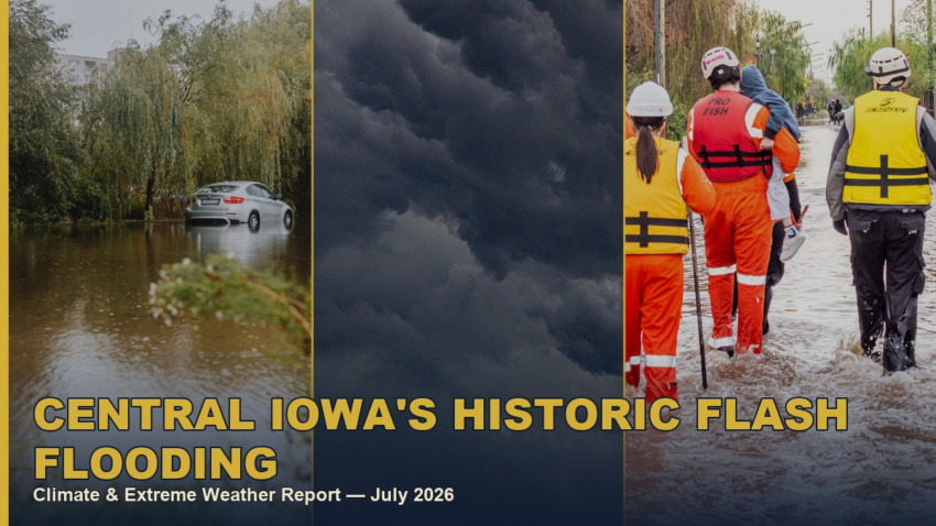
Climate & Extreme Weather Report — July 12, 2026
Key Takeaways
- A slow-moving storm dumped 8–12+ inches of rain on central Iowa between July 2 and July 5, 2026.
- Elkhart, Iowa recorded 12.60 inches of rain in a single 24-hour period.
- Fourmile Creek in Des Moines rose 12 feet in 12 hours, nearly setting a record crest.
- A hospice facility and an apartment complex were both evacuated as water rose.
- Some areas received roughly two months’ worth of normal rainfall in about a day and a half.
1. A Foot of Rain in Two Days
A slow-moving storm system dumped 8 to 12-plus inches of rain across central Iowa between July 2 and July 5, 2026, according to the National Weather Service office in Des Moines. Elkhart, Iowa recorded 12.60 inches of rain in a single 24-hour period, while Ames logged a 48-hour total of 9.11 inches — in some spots, more than two months of normal rainfall fell in roughly a day and a half. (National Weather Service, Des Moines; KCRG)
The storm system stalled almost directly over the Des Moines metro area for the better part of two days, the meteorological signature of what forecasters call a “training” thunderstorm pattern — successive cells moving over the same corridor like train cars on a track, each one dumping more rain onto ground that was already saturated from the previous cell. That stalling behavior, rather than any single storm’s intensity, is what turned a heavy rain event into a historic one.
Video: Fourmile Creek flooding disrupts roadways, businesses in Central Iowa. Source: KCCI.
2. Evacuations and Near-Record Cresting
Fourmile Creek in Des Moines rose 12 feet in just 12 hours, coming close to setting a record crest. UnityPoint’s Taylor House hospice facility was evacuated as water levels rose, along with residents of the Parkside East apartment complex. The City of Des Moines closed multiple roads and trails along the flood control system as the water receded. (Southwest Iowa News Source; City of Des Moines)
3. How to Prepare Before the Next One
Know your home’s actual flood risk before a storm, not during one — FEMA’s Flood Map Service Center lets you check your address against current floodplain maps, but keep in mind this event exceeded modeled expectations in several spots that weren’t officially mapped as high-risk, so proximity to any creek or drainage channel matters even outside a designated flood zone.
Sign up for your county’s emergency alert system (Polk County and Story County both run free text/call alert programs) rather than relying solely on phone weather apps, which can lag official National Weather Service warnings by critical minutes. Keep a go-bag with medications, documents, and a few days of supplies ready year-round, and map at least two evacuation routes from your home in advance — a 12-foot rise in 12 hours does not leave time to plan a route while the water is already moving.
If you rent or own in a flood-adjacent area, ask your insurer directly whether your policy covers flood damage; standard homeowners and renters policies typically do not, and separate flood insurance through the National Flood Insurance Program is worth pricing out even outside a mandatory-purchase zone.
Beyond individual preparedness, this is also a municipal infrastructure story: Des Moines’ flood control system performed as designed and prevented what could have been a far worse outcome, but aging stormwater drainage built for a previous generation’s rainfall patterns is increasingly being outpaced by events like this one. Supporting continued public investment in that infrastructure, not just personal go-bags, is part of what keeps a 12-foot creek rise from becoming a fatal event the next time a storm stalls over central Iowa.
Kemetic Minds Analysis
Flash floods like this one are becoming the signature disaster of a warmer atmosphere — not because any single storm is unprecedented, but because a warmer atmosphere holds more moisture and can dump it faster than drainage infrastructure built decades ago was designed to handle. A 12-foot rise in 12 hours doesn’t give most people meaningful warning time. If you’re in a floodplain-adjacent area, know your evacuation route before the next storm, not during it.
Pair this with our extreme-weather preparedness guide for a practical family action plan.
References
- City of Des Moines. (2026). Flood control road and trail closures. dsm.city
- KCRG. (2026, July 3). More than a foot of rain prompts flooding in Central Iowa. kcrg.com
- National Weather Service, Des Moines. (2026). July 2-4, 2026 flash flooding, Des Moines and Ames. weather.gov
- Southwest Iowa News Source. (2026). Parts of Iowa flooded after storm events that dumped two months worth of rain. swiowanewssource.com
Investigative Methodology: Sourced from the National Weather Service’s official Des Moines office report, KCRG, Southwest Iowa News Source, and the City of Des Moines. No Wikipedia sources and no tweets or social-media posts were used as sourcing. Citations follow APA 7th edition format.
Stay Connected

Kemetic Minds Editorial Desk
Verified NewsroomPrimary-sourced investigative intelligence on civil rights, voting rights, federal policy, and consumer protection. Sourced from primary legal filings, government statistics, and direct field reporting.