
Earth Changes · Daily Report · November 4, 2026, 6:30 AM CST
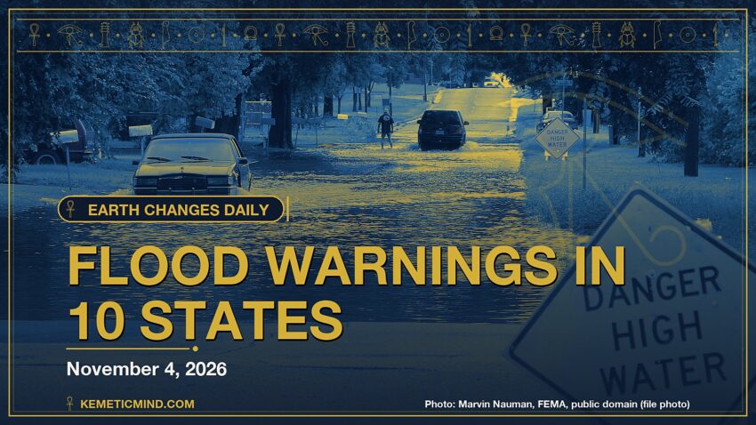
The National Weather Service has 59 severe or extreme alerts in effect, led by 39 flood warnings across AZ, CO, FL, IA and more.[1]
Meanwhile, a magnitude 5.2 earthquake struck 91 km ESE of Kyzyl-Eshme, Kyrgyzstan at 9:34 p.m. UTC on Nov. 3, about 10 km (≈6 miles) below the surface, the U.S. Geological Survey reports[2]. It was one of 9 quakes of magnitude 4.5 or greater in the past day.
Elsewhere, Great Sitkin volcano is at alert level WATCH (aviation color code ORANGE), the Alaska Volcano Observatory says. Its latest update: “Slow eruption of lava within the summit crater continues.”[3]
Today at a Glance
- 9 earthquakes of magnitude 4.5 or greater, the largest M5.2
- 59 severe or extreme U.S. weather alerts
- 3 U.S. volcanoes above normal, including Great Sitkin, Kilauea
- 3 sinkhole reports in the news
Where It’s Happening
Numbered pins match the list under the map. Storm and quake pins are the agencies' reported centers; sinkhole pins mark the town named in the report. Map data: OpenStreetMap contributors.
1. Extreme Weather
The National Hurricane Center is tracking no active tropical storms.[4]
Across the United States, the National Weather Service has 59 alerts rated severe or extreme in effect.[1]
| Alert | Number | States |
|---|---|---|
| Flood Warning | 39 | AZ, CO, FL, IA, KS, LA and more |
| Storm Warning | 12 | PK |
| Heavy Freezing Spray Warning | 7 | PK |
| Flood Watch | 1 | IA |
The Storm Prediction Center says its highest risk level for severe thunderstorms today is marginal, on a scale that runs marginal, slight, enhanced, moderate, high.[5]
2. Earthquakes
The USGS recorded 9 earthquakes of magnitude 4.5 or greater in the past 24 hours.[6] The strongest:
| Mag. | Where | When | Depth | PAGER |
|---|---|---|---|---|
| 5.2 | 91 km ESE of Kyzyl-Eshme, Kyrgyzstan | Nov. 3, 9:34 p.m. UTC | 10 km | — |
| 5.2 | Mid-Indian Ridge | Nov. 3, 6:21 p.m. UTC | 10 km | — |
| 5.2 | Volcano Islands, Japan region | Nov. 3, 4:48 p.m. UTC | 139 km | — |
| 5.0 | 207 km ESE of Sarangani, Philippines | Nov. 4, 7:40 a.m. UTC | 49 km | — |
| 4.9 | South Sandwich Islands region | Nov. 3, 1:34 p.m. UTC | 152 km | — |
| 4.9 | 9 km N of Delta, B.C., MX | Nov. 3, 6:27 p.m. UTC | 16 km | GREEN |
| 4.8 | 85 km S of Gorontalo, Indonesia | Nov. 3, 3:37 p.m. UTC | 137 km | — |
| 4.6 | Fiji region | Nov. 4, 12:32 a.m. UTC | 556 km | — |
PAGER is the USGS estimate of likely deaths and damage: GREEN means little or none expected, RED means extensive. A dash means none was issued.
3. Volcanoes
In the United States, 3 volcanoes are above normal background activity, according to the U.S. Geological Survey’s observatories:
| Volcano | Alert / aviation code | Latest word from scientists |
|---|---|---|
| Great Sitkin | Watch / Orange | Slow eruption of lava within the summit crater continues.[3] |
| Kilauea | Watch / Orange | Lava flows began erupting from the north vent within Halema'uma'u yesterday, November 2, and are continuing this morning. High fountaining remains a possibility today or anytime within the next few days.[7] |
| Ahyi Seamount | Advisory / Yellow | No signs of unrest in satellite data; no significant geophysical signals.[8] |
Alert levels run Normal, Advisory, Watch, Warning. Aviation codes run Green, Yellow, Orange, Red.
4. Sinkholes
No government agency publishes a live national sinkhole feed, so these come from today’s local news:
- NBC News reports, “Nicolas Cage said he is “a little bit homeless” thanks to a sinkhole that has consumed a part of his Southern California home.”[9]
- Franklin County Now reports, “A sinkhole was reported Tuesday evening outside the Great Falls Discovery Center in Turners Falls.”[10]
- New York Post reports, “Man swallowed by massive sinkhole in his own backyard — as pickup truck nearly plunges in Published Nov. 3, 2026, 4:15 p.m. ET See more of our coverage in your search results.”[11]
Also in the News
Other natural-hazard video from the past day, from news organizations:
Video: AccuWeather, November 3, 2026 — “Couple Rescued from Truck that Almost Didn't Make it Out of the Prescott Flood”. Also in the news. Picked because its title names a natural hazard; it may not be covered in the data above.
Video: AccuWeather, November 3, 2026 — “Carolina Coast Tropical Storm Chances Rising | Here's What to Watch”. Also in the news.
5. What the Experts Say
These are the words of the scientists and forecasters who watch these hazards for a living, quoted exactly.
“Thunderstorms with isolated severe wind gusts and perhaps a brief tornado will be possible across parts of the Southeast into the southern Appalachians.”
— NOAA Storm Prediction Center[5]
“Seismicity in the Himalaya dominantly results from the continental collision of the India and Eurasia plates, which are converging at a relative rate of 40-50 mm/yr. Northward underthrusting of India beneath Eurasia generates numerous earthquakes and consequently makes this area one of the most seismically hazardous regions on Earth. The surface expression of the plate boundary is marked by the foothills of the north-south trending Sulaiman Range in the west, the Indo-Burmese Arc in the east and the east-west trending Himalaya Front in the north of India.”
— U.S. Geological Survey, “Seismotectonics of the Himalaya and Vicinity,” on the region around the M5.2 quake[12]
“Lava likely continues to erupt slowly within the summit crater of Great Sitkin Volcano. Only two small earthquakes were detected at the volcano over the last day. Clouds obscured other satellite and webcam views of the volcano.”
— Alaska Volcano Observatory, on Great Sitkin[3]
“Lava flows began yesterday, November 2, from the north vent in Halemaʻumaʻu and are continuing this morning. Minor deflation that began just around 1:00 p.m. yesterday has slowed and may be turning back to inflation. Seismic tremor at the summit is elevated with fluctuations in tremor associated with the beginning and end of lava overflows.”
— Hawaiian Volcano Observatory, on Kilauea[7]
“Sinkholes are common where the rock below the land surface is limestone, carbonate rock, salt beds, or other rocks that can naturally be dissolved by groundwater circulating through them. As the rock dissolves, spaces and caverns develop underground. Sinkholes are dramatic because the land usually stays intact for a while until the underground spaces just get too big.”
— U.S. Geological Survey Water Science School, on why sinkholes form[13]
How to Prepare
- Keep a basic kit: water (one gallon per person per day for several days), food, a battery or hand-crank radio, a whistle, a dust mask and phone chargers.[14]
- Get alerts: Wireless Emergency Alerts need no sign-up; the FEMA app, NOAA Weather Radio, the USGS Earthquake Notification Service and the USGS Volcano Notification Service are free.
- Floods: Turn Around, Don’t Drown. Six inches of moving water can knock you down, and one foot can sweep a car away.[15]
- Earthquakes: Drop, Cover and Hold On.[16]
How to Verify This Yourself
- Earthquakes: USGS Latest Earthquakes map
- U.S. volcanoes: USGS Volcano Hazards Program; world: Smithsonian weekly report
- Weather alerts: weather.gov/alerts; tropics: nhc.noaa.gov
- Worldwide disasters: gdacs.org
References
- National Weather Service, active alerts API api.weather.gov. ↩
- USGS, M5.2 91 km ESE of Kyzyl-Eshme, Kyrgyzstan event page earthquake.usgs.gov. ↩
- Alaska Volcano Observatory, Great Sitkin notice volcanoes.usgs.gov. ↩
- National Hurricane Center, active storms data nhc.noaa.gov. ↩
- NOAA Storm Prediction Center, Day 1 Convective Outlook spc.noaa.gov. ↩
- USGS, M4.5+ earthquakes, past day (real-time feed) earthquake.usgs.gov. ↩
- Hawaiian Volcano Observatory, Kilauea notice volcanoes.usgs.gov. ↩
- Northern Mariana Islands, Ahyi Seamount notice volcanoes.usgs.gov. ↩
- NBC News, Nicolas Cage says he’s ‘a little bit homeless’ as sinkhole swallows his Malibu home nbcnews.com. ↩
- Franklin County Now, Sinkhole opens near Great Falls Discovery Center franklincountynow.com. ↩
- New York Post, Man swallowed by massive sinkhole in his own backyard — as pickup truck nearly plunges in nypost.com. ↩
- USGS Geoserve, tectonic summary earthquake.usgs.gov. ↩
- USGS Water Science School, Sinkholes usgs.gov. ↩
- Ready.gov (FEMA), Build a Kit ready.gov. ↩
- Ready.gov (FEMA), Floods ready.gov. ↩
- Ready.gov (FEMA), Earthquakes ready.gov. ↩
Methodology: this report is assembled automatically each morning from the live data feeds of the USGS, the Smithsonian Global Volcanism Program, the National Weather Service, the National Hurricane Center, the Storm Prediction Center and GDACS, plus same-day news reports for sinkholes. No AI writes it: the sentences are fixed templates filled with that data, and every quote is copied exactly from the source it is credited to. Data can change after publication; follow the links for the latest.

Kemetic Minds Editorial Desk
Verified NewsroomPrimary-sourced investigative intelligence on civil rights, voting rights, federal policy, and consumer protection. Sourced from primary legal filings, government statistics, and direct field reporting.