
Earth Changes · Daily Report · October 16, 2026, 6:30 AM CDT
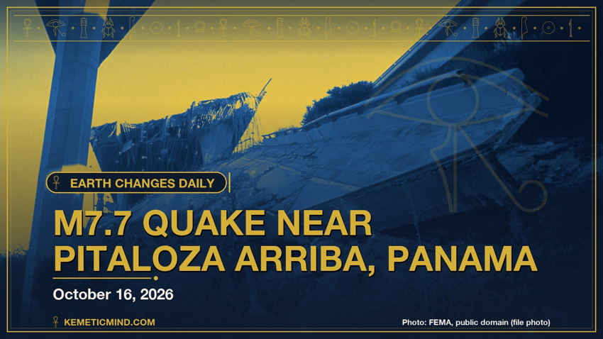
A magnitude 7.7 earthquake struck 12 km WSW of Pitaloza Arriba, Panama at 5:56 p.m. UTC on Oct. 9, about 13 km (≈8 miles) below the surface, the U.S. Geological Survey reports[1]. The USGS PAGER system rates the expected impact ORANGE. It is the strongest earthquake tracked by the USGS this week, with active aftershocks continuing across the region.
Meanwhile, Hurricane Trudy is churning in the eastern Pacific with top winds near 120 mph and a central pressure of 956 millibars, moving northwest at 6 mph, according to the National Hurricane Center.[2]
Elsewhere, the National Weather Service has 120 severe or extreme alerts in effect, led by 3 typhoon warnings across GU, MP, PM.[3]
Today at a Glance
- 11 earthquakes of magnitude 4.5 or greater, the largest M6.9
- 2 active tropical systems: Hurricane Trudy, Tropical Storm Simon
- 120 severe or extreme U.S. weather alerts
- 4 U.S. volcanoes above normal, including Great Sitkin, Kilauea
- 3 sinkhole reports in the news
Could not be reached for this edition: Smithsonian weekly volcano report.
Where It’s Happening
Numbered pins match the list under the map. Storm and quake pins are the agencies' reported centers; sinkhole pins mark the town named in the report. Map data: OpenStreetMap contributors.
1. Extreme Weather
Tropical storms and hurricanes
- Hurricane Trudy (eastern Pacific): top winds near 120 mph, moving northwest at 6 mph. Latest advisory.[2]
- Tropical Storm Simon (eastern Pacific): top winds near 40 mph, moving northwest at 9 mph. Latest advisory.[2]
Across the United States, the National Weather Service has 120 alerts rated severe or extreme in effect.[3]
| Alert | Number | States |
|---|---|---|
| Typhoon Warning | 3 | GU, MP, PM |
| Freeze Warning | 27 | CO, IA, IL, KS, MN, ND and more |
| Freeze Watch | 24 | CO, IA, KS, MN, MO, NE and more |
| Flood Warning | 15 | FL, GA, OK, TX |
| High Wind Warning | 15 | AK, AZ, CA, NM, TX |
| Red Flag Warning | 14 | AR, CA, LA, MS, OK, TX |
| Fire Weather Watch | 6 | AR, LA, MS, TX |
| Heavy Freezing Spray Warning | 5 | PK |
| Flood Watch | 3 | AK, GU, MP |
| High Wind Watch | 2 | MT, WY |
Typhoon Warning issued October 16 at 4:51PM ChST by NWS Tiyan GU (Guam Coastal Waters; Rota Coastal Waters): “* WHAT….Typhoon conditions, including winds of 64 knots or more are expected. * WHERE…Guam Coastal Waters and Rota Coastal Waters. * WHEN…Onset of damaging winds beginning Saturday night. Onset of destructive winds Sunday morning.”
Typhoon Warning issued October 16 at 4:11PM ChST by NWS Tiyan GU (Guam): “…TROPICAL STORM CHAMPI MOVING RAPIDLY WEST ON APPROACH TO THE MARIANAS… …CHAMPI LIKELY TO MOVE NEAR GUAM AND ROTA AS A TYPHOON… .NEW INFORMATION… A Typhoon Warning has been issued for Guam, Rota, and the adjacent waters.”
The Storm Prediction Center says its highest risk level for severe thunderstorms today is slight, on a scale that runs marginal, slight, enhanced, moderate, high.[4]
Around the world, GDACS, the global disaster alert system run by the United Nations and the European Commission, lists these Orange or Red alerts from the past two days:
- Orange: Orange notification for tropical cyclone CHAMPI-26. Population affected by Category 1 (120 km/h) wind speeds or higher is 0.175 million .[5]
2. Earthquakes
The USGS recorded 11 earthquakes of magnitude 4.5 or greater in the past 24 hours.[6] The strongest:
| Mag. | Where | When | Depth | PAGER |
|---|---|---|---|---|
| 6.9 | 76 km NE of Ozernovskiy, Russia | Oct. 16, 3:35 a.m. UTC | 135 km | GREEN |
| 5.2 | 107 km NNE of Hihifo, Tonga | Oct. 15, 1:29 p.m. UTC | 10 km | — |
| 5.2 | 157 km W of Sola, Vanuatu | Oct. 15, 1:06 p.m. UTC | 10 km | — |
| 4.9 | 31 km ENE of Kinablangan, Philippines | Oct. 16, 9:13 a.m. UTC | 74 km | — |
| 4.9 | 198 km SSE of Vilyuchinsk, Russia | Oct. 15, 2:59 p.m. UTC | 10 km | — |
| 4.8 | southern East Pacific Rise | Oct. 16, 9:04 a.m. UTC | 10 km | — |
| 4.7 | 95 km SW of Brisas Barra de Suchiate, Mexico | Oct. 16, 4:42 a.m. UTC | 10 km | — |
| 4.7 | 114 km SSW of Nikolski, Alaska | Oct. 15, 1:16 p.m. UTC | 10 km | — |
PAGER is the USGS estimate of likely deaths and damage: GREEN means little or none expected, RED means extensive. A dash means none was issued.
Earlier this week: The USGS is also continuing to monitor ongoing aftershocks and impacts from significant earthquakes recorded over the past seven days:[7]
| Mag. | Where | When | Depth | PAGER |
|---|---|---|---|---|
| 7.7 | 12 km WSW of Pitaloza Arriba, Panama | Oct. 9, 5:56 p.m. UTC | 13 km | ORANGE |
| 6.8 | central Mid-Atlantic Ridge | Oct. 13, 12:23 p.m. UTC | 10 km | GREEN |
| 6.7 | central Mid-Atlantic Ridge | Oct. 13, 5:44 a.m. UTC | 10 km | GREEN |
| 6.6 | 12 km W of Río Grande, Panama | Oct. 9, 8:25 p.m. UTC | 24 km | YELLOW |
3. Volcanoes
In the United States, 4 volcanoes are above normal background activity, according to the U.S. Geological Survey’s observatories:
| Volcano | Alert / aviation code | Latest word from scientists |
|---|---|---|
| Great Sitkin | Watch / Orange | Slow eruption of lava within the summit crater continues.[8] |
| Kilauea | Watch / Orange | Intermittent overflows from the north vent resumed yesterday and continued through day; less frequent overnight. Kīlauea's summit remains at a high level of pressurization with changes in eruptive activity or location within the summit region possible.[9] |
| Ahyi Seamount | Advisory / Yellow | Plumes of discolored water seen in satellite imagery; no significant geophysical signals.[10] |
| Shishaldin | Advisory / Yellow | Low-level unrest continues.[8] |
Alert levels run Normal, Advisory, Watch, Warning. Aviation codes run Green, Yellow, Orange, Red.
4. Sinkholes
No government agency publishes a live national sinkhole feed, so these come from today’s local news:
- Los Feliz: Yahoo reports, “New sinkhole opens on Covina street after separate sinkhole nearly swallows van in Los Feliz Another sinkhole opened up overnight in Covina, less than 24 hours after a separate massive sinkhole nearly swallowed a van in Los Angeles County.”[11]
- AOL.com reports, “Nicolas Cage's $10.5 Million Malibu Home Is Threatened by a Growing Sinkhole as He Seeks Emergency Repairs Nicolas Cage has obtained approval for emergency work to protect his $10.5 million Malibu home from a growing sinkhole.”[12]
- The Citizen reports, “FOLLOW-UP: Snake Road sinkhole repairs face further delays In a statement released by the provincial government on January 8, it was stated that a contractor had been appointed to investigate the sinkhole and determine the methodology for repairs.”[13]
Also in the News
Other natural-hazard video from the past day, from news organizations:
Video: Reuters, October 16, 2026 — “LIVE: World financial leaders meet in Thailand”. Also in the news. Picked because its title names a natural hazard; it may not be covered in the data above.
Video: ABC News, October 16, 2026 — “People dance joyfully in flooded Turkish streets”. Also in the news.
5. What the Experts Say
These are the words of the scientists and forecasters who watch these hazards for a living, quoted exactly.
“Trudy has rapidly strengthened into a major hurricane overnight. Its 15-n-mi wide eye, which is evident in proxy-visible and infrared satellite imagery, is surrounded by a solid ring of very deep convection with cloud tops colder than -70 deg C. A prominent outer band wraps around the northwestern portion of the circulation. The initial intensity is set at 105 kt for this advisory, trending closer to recent Dvorak estimates in lieu of the objective estimates that appear too low given Trudy's impressive satellite structure.”
— Forecaster Reinhart, National Hurricane Center, on Hurricane Trudy[14]
“Simon is gradually weakening. The storm continues to lose organization with intermittent bursts of deeper convection north of the center. A 0501 UTC Metop-C scatterometer pass showed a compact system with peak winds around 34 kt. Intensity estimates have dropped slightly, and the latest subjective Dvorak CI number from TAFB was 2.5/35 kt, but the Final T-number was 2.0/30 kt. Based on a compromise of these data, the initial intensity is lowered to 35 kt.”
— Forecaster Pierce/Reinhart, National Hurricane Center, on Tropical Storm Simon[15]
“Thunderstorms with wind-damage and localized brief-tornado potential are expected across parts of the Mid-Atlantic into southern New England, mainly this afternoon and early evening.”
— NOAA Storm Prediction Center[4]
“The Kuril-Kamchatka Arc extends approximately 2,100 km from Hokkaido, Japan along the Kuril Islands and the Pacific coast of the Kamchatka Peninsula, until terminating at its intersection with the Aleutian arc south of the Commander Islands, Russia. It marks the region where the Pacific plate subducts into the mantle beneath the Okhotsk mircoplate, a proposed regional subdivision of the larger North America plate. This subduction is responsible for the generation of the Kuril Islands chain, volcanoes along the entire arc, and the deep Kuril-Kamchatka Trench.”
— U.S. Geological Survey, “Seismotectonics of the Kuril-Kamchatka Arc,” on the region around the M6.9 quake[16]
“Lava continues to erupt slowly within the summit crater of Great Sitkin Volcano. One small earthquake was detected in the past day. No activity was observed in mostly cloudy webcam and satellite images over the past day.”
— Alaska Volcano Observatory, on Great Sitkin[8]
“Overflows from the north vent resumed yesterday at 11:08 AM HST and continued intermittently throughout the day with 12 recorded by sundown, as well as one overflow from the south vent. Numerous instances of spatter from all three vents (north, south, and west) were also observed. Conditions overnight led to difficult viewing, nonetheless spatter was visible from all vents, as well as an additional overflow accompanied by gas jetting from the north vent at 4:46 AM.”
— Hawaiian Volcano Observatory, on Kilauea[9]
“Sinkholes are common where the rock below the land surface is limestone, carbonate rock, salt beds, or other rocks that can naturally be dissolved by groundwater circulating through them. As the rock dissolves, spaces and caverns develop underground. Sinkholes are dramatic because the land usually stays intact for a while until the underground spaces just get too big.”
— U.S. Geological Survey Water Science School, on why sinkholes form[17]
How to Prepare
- Keep a basic kit: water (one gallon per person per day for several days), food, a battery or hand-crank radio, a whistle, a dust mask and phone chargers.[18]
- Get alerts: Wireless Emergency Alerts need no sign-up; the FEMA app, NOAA Weather Radio, the USGS Earthquake Notification Service and the USGS Volcano Notification Service are free.
- Floods: Turn Around, Don’t Drown. Six inches of moving water can knock you down, and one foot can sweep a car away.[19]
- Earthquakes: Drop, Cover and Hold On.[20]
- Download the checklist: Be Ready: Earthquakes, Volcanoes, Extreme Weather and Sinkholes (PDF), with today’s active hazards first.
How to Verify This Yourself
- Earthquakes: USGS Latest Earthquakes map
- U.S. volcanoes: USGS Volcano Hazards Program; world: Smithsonian weekly report
- Weather alerts: weather.gov; tropics: nhc.noaa.gov
- Worldwide disasters: gdacs.org
References
- USGS, M7.7 12 km WSW of Pitaloza Arriba, Panama event page earthquake.usgs.gov. ↩
- National Hurricane Center, active storms data nhc.noaa.gov. ↩
- National Weather Service, active alerts API api.weather.gov. ↩
- NOAA Storm Prediction Center, Day 1 Convective Outlook spc.noaa.gov. ↩
- GDACS event page gdacs.org. ↩
- USGS, M4.5+ earthquakes, past day (real-time feed) earthquake.usgs.gov. ↩
- USGS, Significant earthquakes past week (real-time feed) earthquake.usgs.gov. ↩
- Alaska Volcano Observatory, Great Sitkin notice volcanoes.usgs.gov. ↩
- Hawaiian Volcano Observatory, Kilauea notice volcanoes.usgs.gov. ↩
- Northern Mariana Islands, Ahyi Seamount notice volcanoes.usgs.gov. ↩
- Yahoo, New sinkhole opens on Covina street after separate sinkhole nearly swallows van in Los Feliz yahoo.com. ↩
- AOL.com, Nicolas Cage's $10.5 Million Malibu Home Is Threatened by a Growing Sinkhole as He Seeks Emergency Repairs aol.com. ↩
- The Citizen, FOLLOW-UP: Snake Road sinkhole repairs face further delays citizen.co.za. ↩
- National Hurricane Center, Trudy forecast discussion nhc.noaa.gov. ↩
- National Hurricane Center, Simon forecast discussion nhc.noaa.gov. ↩
- USGS Geoserve, tectonic summary earthquake.usgs.gov. ↩
- USGS Water Science School, Sinkholes usgs.gov. ↩
- Ready.gov (FEMA), Build a Kit ready.gov. ↩
- Ready.gov (FEMA), Floods ready.gov. ↩
- Ready.gov (FEMA), Earthquakes ready.gov. ↩
Methodology: this report is assembled automatically each morning from the live data feeds of the USGS, the Smithsonian Global Volcanism Program, the National Weather Service, the National Hurricane Center, the Storm Prediction Center and GDACS, plus same-day news reports for sinkholes. No AI writes it: the sentences are fixed templates filled with that data, and every quote is copied exactly from the source it is credited to. Data can change after publication; follow the links for the latest.

Kemetic Minds Editorial Desk
Verified NewsroomPrimary-sourced investigative intelligence on civil rights, voting rights, federal policy, and consumer protection. Sourced from primary legal filings, government statistics, and direct field reporting.