Earth Changes · Daily Report · October 15, 2026, 6:30 AM CDT
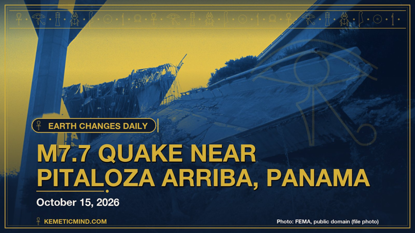
A magnitude 7.7 earthquake struck 12 km WSW of Pitaloza Arriba, Panama at 5:56 p.m. UTC on Oct. 9, about 13 km (≈8 miles) below the surface, the U.S. Geological Survey reports[1]. The USGS PAGER system rates the expected impact ORANGE. It is the strongest earthquake tracked by the USGS this week, with active aftershocks continuing across the region.
Meanwhile, Hurricane Trudy is churning in the eastern Pacific with top winds near 75 mph and a central pressure of 989 millibars, moving northwest at 9 mph, according to the National Hurricane Center.[2]
Elsewhere, the National Weather Service has 93 severe or extreme alerts in effect, led by 21 storm warnings across PK.[3]
Today at a Glance
- 5 earthquakes of magnitude 4.5 or greater, the largest M5.6
- 2 active tropical systems: Hurricane Trudy, Tropical Storm Simon
- 93 severe or extreme U.S. weather alerts
- 4 U.S. volcanoes above normal, including Great Sitkin, Kilauea
- 3 sinkhole reports in the news
Could not be reached for this edition: Smithsonian weekly volcano report.
Where It’s Happening
Numbered pins match the list under the map. Storm and quake pins are the agencies' reported centers; sinkhole pins mark the town named in the report. Map data: OpenStreetMap contributors.
1. Extreme Weather
Tropical storms and hurricanes
- Hurricane Trudy (eastern Pacific): top winds near 75 mph, moving northwest at 9 mph. Latest advisory.[2]
- Tropical Storm Simon (eastern Pacific): top winds near 60 mph. Latest advisory.[2]
Across the United States, the National Weather Service has 93 alerts rated severe or extreme in effect.[3]
| Alert | Number | States |
|---|---|---|
| Storm Warning | 21 | PK |
| High Wind Warning | 13 | AZ, CA, NM, TX |
| Flood Watch | 12 | AK, KS, MO, OK, TX |
| Flood Warning | 11 | FL, GA, KS, OK, TX |
| Freeze Watch | 9 | CO, KS, NE, NM, WY |
| Freeze Warning | 7 | CO, NM, SD, WY |
| Red Flag Warning | 6 | CA |
| Fire Weather Watch | 5 | AR, CA, LA, MS, OK, TX |
| Flash Flood Warning | 5 | OK, TX |
| Typhoon Watch | 2 | GU, MP, PM |
The Storm Prediction Center says its highest risk level for severe thunderstorms today is marginal, on a scale that runs marginal, slight, enhanced, moderate, high.[4]
Around the world, GDACS, the global disaster alert system run by the United Nations and the European Commission, lists these Orange or Red alerts from the past two days:
- Orange: Orange notification for tropical cyclone CHAMPI-26. Population affected by Category 1 (120 km/h) wind speeds or higher is 0.175 million .[5]
2. Earthquakes
The USGS recorded 5 earthquakes of magnitude 4.5 or greater in the past 24 hours.[6] The strongest:
| Mag. | Where | When | Depth | PAGER |
|---|---|---|---|---|
| 5.6 | 43 km NNW of Lake Minchumina, Alaska | Oct. 15, 11:07 a.m. UTC | 4 km | — |
| 5.3 | 43 km SSE of Otorohanga, New Zealand | Oct. 15, 5:25 a.m. UTC | 286 km | GREEN |
| 5.1 | 36 km E of Safotu, Samoa | Oct. 15, 3:36 a.m. UTC | 13 km | — |
| 4.8 | 30 km E of Safotu, Samoa | Oct. 15, 3:36 a.m. UTC | 13 km | — |
| 4.5 | 82 km SSW of Mil’kovo, Russia | Oct. 14, 11:20 p.m. UTC | 183 km | — |
PAGER is the USGS estimate of likely deaths and damage: GREEN means little or none expected, RED means extensive. A dash means none was issued.
Earlier this week: The USGS is also continuing to monitor ongoing aftershocks and impacts from significant earthquakes recorded over the past seven days:[7]
| Mag. | Where | When | Depth | PAGER |
|---|---|---|---|---|
| 7.7 | 12 km WSW of Pitaloza Arriba, Panama | Oct. 9, 5:56 p.m. UTC | 13 km | ORANGE |
| 6.8 | central Mid-Atlantic Ridge | Oct. 13, 12:23 p.m. UTC | 10 km | GREEN |
| 6.7 | central Mid-Atlantic Ridge | Oct. 13, 5:44 a.m. UTC | 10 km | GREEN |
| 6.6 | 12 km W of Río Grande, Panama | Oct. 9, 8:25 p.m. UTC | 24 km | YELLOW |
3. Volcanoes
In the United States, 4 volcanoes are above normal background activity, according to the U.S. Geological Survey’s observatories:
| Volcano | Alert / aviation code | Latest word from scientists |
|---|---|---|
| Great Sitkin | Watch / Orange | Slow eruption of lava within the summit crater continues.[8] |
| Kilauea | Watch / Orange | Strong glow and minor intermittent spattering continue from the north, south, and west south vents since October 6. Minor overllows occurred from the north vent on October 12 and 14.[9] |
| Ahyi Seamount | Advisory / Yellow | No plumes seen in satellite images; no significant geophysical signals.[10] |
| Shishaldin | Advisory / Yellow | Low-level unrest continues.[8] |
Alert levels run Normal, Advisory, Watch, Warning. Aviation codes run Green, Yellow, Orange, Red.
4. Sinkholes
No government agency publishes a live national sinkhole feed, so these come from today’s local news:
- ABC7 Los Angeles reports, “A massive sinkhole opened up late Wednesday morning on a residential street in Los Feliz, nearly swallowing a van, as water from a water main break flooded the scene.”[11]
- Los Feliz: NBC Los Angeles reports, “Crews were working to repair a sinkhole near a water main break site in Los Feliz after a work van fell into it, officials said Wednesday.”[12]
- Page Six reports, “Celebrity News exclusive Nicolas Cage trying to save $10.5 million Malibu home as massive sinkhole continues to grow By Nate Grant and Published Oct. 14, 2026, 7:05 p.m. ET See more of our coverage in your search results.”[13]
Also in the News
Other natural-hazard video from the past day, from news organizations:
Video: Al Jazeera English, October 15, 2026 — “Istanbul floods leave residents stranded | AJ #shorts”. Also in the news. Picked because its title names a natural hazard; it may not be covered in the data above.
Video: BBC News, October 15, 2026 — “Waterspouts form off Rhodes island as severe storms batter Greece. #Rhodes #Greece #BBCNews”. Also in the news.
5. What the Experts Say
These are the words of the scientists and forecasters who watch these hazards for a living, quoted exactly.
“Trudy's satellite presentation continues to improve, with an expanding central dense overcast containing cloud tops as cold as -85 degrees C and a curved convective band wrapping into the circulation from the north. Earlier microwave passes revealed improving inner-core organization, while a 0339 UTC MetOp-B scatterometer pass helped refine the cyclone's wind radii and structure. The latest subjective Dvorak intensity estimate from TAFB is T4.0/65 kt, which is consistent with the latest objective estimates. Based on these data, the initial intensity is increased to 65 kt, making Trudy a category 1 hurricane on the Saffir-Simpson Hurricane Wind Scale.”
— Forecaster Gibbs, National Hurricane Center, on Hurricane Trudy[14]
“The satellite presentation of Simon has not changed much since the prior advisory. The center of the tropical storm remains embedded underneath a small, cold central dense overcast. No recent passive microwave data is available to assess the internal structure of Simon, but conventional satellite images indicate it is still a small storm. The initial intensity is lowered slightly to 50 kt. This is based on a blend of the TAFB Dvorak estimate (T3.5/55 kt) and the latest UW-CIMSS objective estimates (43-52 kt), with some consideration given to the earlier aircraft data as well.”
— Forecaster Reinhart, National Hurricane Center, on Tropical Storm Simon[15]
“Thunderstorms with isolated severe wind gusts and perhaps a tornado or two are possible today across parts of the mid Mississippi and Ohio Valleys. Additional storms with isolated severe wind gusts will be possible in parts of the southern Plains.”
— NOAA Storm Prediction Center[4]
“Extensive diversity and complexity of tectonic regimes characterizes the perimeter of the Caribbean plate, involving no fewer than four major plates (North America, South America, Nazca, and Cocos). Inclined zones of deep earthquakes (Wadati-Benioff zones), ocean trenches, and arcs of volcanoes clearly indicate subduction of oceanic lithosphere along the Central American and Atlantic Ocean margins of the Caribbean plate, while crustal seismicity in Guatemala, northern Venezuela, and the Cayman Ridge and Cayman Trench indicate transform fault and pull-apart basin tectonics. Along the northern margin of the Caribbean plate, the North America plate moves westwards with respect to the Caribbean plate at a velocity of approximately 20 mm/yr.”
— U.S. Geological Survey, “Seismotectonics of the Caribbean Region and Vicinity,” on the region around the M5.6 quake[16]
“Lava continues to erupt slowly within the summit crater of Great Sitkin Volcano. A few small earthquakes were detected in the past day. No activity was observed in mostly cloudy webcam and satellite images over the past day.”
— Alaska Volcano Observatory, on Great Sitkin[8]
“No notable activity was detected in distal geophysical monitoring data or satellite images over the past week.”
— Northern Mariana Islands, on Ahyi Seamount[10]
“Sinkholes are common where the rock below the land surface is limestone, carbonate rock, salt beds, or other rocks that can naturally be dissolved by groundwater circulating through them. As the rock dissolves, spaces and caverns develop underground. Sinkholes are dramatic because the land usually stays intact for a while until the underground spaces just get too big.”
— U.S. Geological Survey Water Science School, on why sinkholes form[17]
How to Prepare
- Keep a basic kit: water (one gallon per person per day for several days), food, a battery or hand-crank radio, a whistle, a dust mask and phone chargers.[18]
- Get alerts: Wireless Emergency Alerts need no sign-up; the FEMA app, NOAA Weather Radio, the USGS Earthquake Notification Service and the USGS Volcano Notification Service are free.
- Floods: Turn Around, Don’t Drown. Six inches of moving water can knock you down, and one foot can sweep a car away.[19]
- Earthquakes: Drop, Cover and Hold On.[20]
- Download the checklist: Be Ready: Earthquakes, Volcanoes, Extreme Weather and Sinkholes (PDF), with today’s active hazards first.
How to Verify This Yourself
- Earthquakes: USGS Latest Earthquakes map
- U.S. volcanoes: USGS Volcano Hazards Program; world: Smithsonian weekly report
- Weather alerts: weather.gov; tropics: nhc.noaa.gov
- Worldwide disasters: gdacs.org
References
- USGS, M7.7 12 km WSW of Pitaloza Arriba, Panama event page earthquake.usgs.gov. ↩
- National Hurricane Center, active storms data nhc.noaa.gov. ↩
- National Weather Service, active alerts API api.weather.gov. ↩
- NOAA Storm Prediction Center, Day 1 Convective Outlook spc.noaa.gov. ↩
- GDACS event page gdacs.org. ↩
- USGS, M4.5+ earthquakes, past day (real-time feed) earthquake.usgs.gov. ↩
- USGS, Significant earthquakes past week (real-time feed) earthquake.usgs.gov. ↩
- Alaska Volcano Observatory, Great Sitkin notice volcanoes.usgs.gov. ↩
- Hawaiian Volcano Observatory, Kilauea notice volcanoes.usgs.gov. ↩
- Northern Mariana Islands, Ahyi Seamount notice volcanoes.usgs.gov. ↩
- ABC7 Los Angeles, Massive sinkhole nearly swallows van on residential street in Los Feliz after water main break abc7.com. ↩
- NBC Los Angeles, Giant sinkhole swallows a truck in Los Feliz nbclosangeles.com. ↩
- Page Six, Exclusive | Nicolas Cage trying to save $10.5 million Malibu home as massive sinkhole continues to grow pagesix.com. ↩
- National Hurricane Center, Trudy forecast discussion nhc.noaa.gov. ↩
- National Hurricane Center, Simon forecast discussion nhc.noaa.gov. ↩
- USGS Geoserve, tectonic summary earthquake.usgs.gov. ↩
- USGS Water Science School, Sinkholes usgs.gov. ↩
- Ready.gov (FEMA), Build a Kit ready.gov. ↩
- Ready.gov (FEMA), Floods ready.gov. ↩
- Ready.gov (FEMA), Earthquakes ready.gov. ↩
Methodology: this report is assembled automatically each morning from the live data feeds of the USGS, the Smithsonian Global Volcanism Program, the National Weather Service, the National Hurricane Center, the Storm Prediction Center and GDACS, plus same-day news reports for sinkholes. No AI writes it: the sentences are fixed templates filled with that data, and every quote is copied exactly from the source it is credited to. Data can change after publication; follow the links for the latest.

Kemetic Minds Editorial Desk
Verified NewsroomPrimary-sourced investigative intelligence on civil rights, voting rights, federal policy, and consumer protection. Sourced from primary legal filings, government statistics, and direct field reporting.