
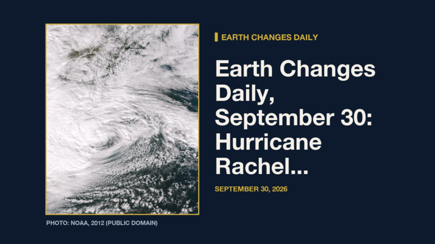
Earth Changes · Daily Report · September 30, 2026
Hurricane Rachel is churning in the eastern Pacific with top winds near 85 mph and a central pressure of 979 millibars, moving northwest at 10 mph, according to the National Hurricane Center.[1] It is one of 5 tropical systems the center is tracking, along with Tropical Storm Nolo, Tropical Storm Hanna, Potential Tropical Cyclone Polo and Tropical Depression Nineteen-E.
Meanwhile, the National Weather Service has 61 severe or extreme alerts in effect, led by 37 flood watches across AZ, CO, IA, IL and more.[2]
Elsewhere, a magnitude 5.6 earthquake struck 74 km S of Yonakuni, Japan at 5:00 a.m. UTC on Sept. 30, about 11 km (≈7 miles) below the surface, the U.S. Geological Survey reports[3]. The USGS PAGER system rates the expected impact GREEN. It was one of 21 quakes of magnitude 4.5 or greater in the past day.
Today at a Glance
- 21 earthquakes of magnitude 4.5 or greater, the largest M5.6
- 5 active tropical systems: Hurricane Rachel, Tropical Storm Nolo, Tropical Storm Hanna, Potential Tropical Cyclone Polo, Tropical Depression Nineteen-E
- 61 severe or extreme U.S. weather alerts
- 4 U.S. volcanoes above normal, including Great Sitkin, Kilauea
- 3 sinkhole reports in the news
Where It’s Happening
Numbered pins match the list under the map. Storm and quake pins are the agencies' reported centers; sinkhole pins mark the town named in the report. Map data: OpenStreetMap contributors.
1. Extreme Weather
Tropical storms and hurricanes
- Hurricane Rachel (eastern Pacific): top winds near 85 mph, moving northwest at 10 mph. Latest advisory.[1]
- Tropical Storm Nolo (eastern Pacific): top winds near 70 mph, moving west-northwest at 6 mph. Latest advisory.[1]
- Tropical Storm Hanna (Atlantic): top winds near 40 mph, moving east-southeast at 5 mph. Latest advisory.[1]
- Potential Tropical Cyclone Polo (eastern Pacific): top winds near 35 mph, moving northeast at 23 mph. Latest advisory.[1]
- Tropical Depression Nineteen-E (eastern Pacific): top winds near 30 mph, moving east-southeast at 9 mph. Latest advisory.[1]
Across the United States, the National Weather Service has 61 alerts rated severe or extreme in effect.[2]
| Alert | Number | States |
|---|---|---|
| Flood Watch | 37 | AZ, CO, IA, IL, KS, MO and more |
| Flood Warning | 14 | AZ, FL, IA, IL, KS, MA and more |
| Flash Flood Warning | 7 | TX |
| Heavy Freezing Spray Warning | 2 | PK |
| Extreme Heat Watch | 1 | CA |
The Storm Prediction Center says its highest risk level for severe thunderstorms today is slight, on a scale that runs marginal, slight, enhanced, moderate, high.[4]
Around the world, GDACS logged 55 wildfire, 5 flood, 3 tropical cyclone, 2 earthquake notices in the past two days, all at its lowest (Green) level.[5]
Video: AccuWeather, September 29, 2026 — “Waterfall before vs. after Hurricane Nolo”. Matched to this report by the storm, volcano or place name in its title.
Video: DW News, September 30, 2026 — “Residents take stock after Hurricane Polo batters Mexico's Pacific coast | DW News”. Matched to this report by the storm, volcano or place name in its title.
Video: TRT World, Turkey's public English-language broadcaster, verified Telegram channel, September 29, 2026 — “High school students in France blocked school entrances, set fire to electric bicycles and rubbish bins, and clashed with police as protests spread across the country. Students are protesting poor learning conditions, ov” Topic: extreme heat. Picked by hazard keywords in the channel’s own caption.
2. Earthquakes
The USGS recorded 21 earthquakes of magnitude 4.5 or greater in the past 24 hours.[6] The strongest:
| Mag. | Where | When | Depth | PAGER |
|---|---|---|---|---|
| 5.6 | 74 km S of Yonakuni, Japan | Sept. 30, 5:00 a.m. UTC | 11 km | GREEN |
| 5.6 | southern Mid-Atlantic Ridge | Sept. 29, 1:06 p.m. UTC | 10 km | GREEN |
| 5.4 | Balleny Islands region | Sept. 30, 4:48 a.m. UTC | 10 km | GREEN |
| 5.4 | 99 km SSE of Pangai, Tonga | Sept. 29, 12:40 p.m. UTC | 10 km | GREEN |
| 5.2 | Balleny Islands region | Sept. 30, 7:07 a.m. UTC | 10 km | — |
| 5.1 | 121 km S of Kokopo, Papua New Guinea | Sept. 30, 8:15 a.m. UTC | 28 km | — |
| 5.0 | 27 km N of Kupang, Indonesia | Sept. 30, 10:58 a.m. UTC | 19 km | — |
| 5.0 | 83 km NE of Tadine, New Caledonia | Sept. 30, 6:50 a.m. UTC | 10 km | — |
PAGER is the USGS estimate of likely deaths and damage: GREEN means little or none expected, RED means extensive. A dash means none was issued.
3. Volcanoes
In the United States, 4 volcanoes are above normal background activity, according to the U.S. Geological Survey’s observatories:
| Volcano | Alert / aviation code | Latest word from scientists |
|---|---|---|
| Great Sitkin | Watch / Orange | Slow eruption of lava within the summit crater continues.[7] |
| Kilauea | Watch / Orange | Numerous rapid cycles of south vent overflows and drainback occurred overnight within Halema'uma'u crater at the summit of Kīlauea. The north and south vents had strong glow and intermittent spatter. There is no anomalous activity outside of the summit.[8] |
| Ahyi Seamount | Advisory / Yellow | No plumes seen in satellite images; no significant geophysical signals.[9] |
| Shishaldin | Advisory / Yellow | Low-level unrest continues.[7] |
Alert levels run Normal, Advisory, Watch, Warning. Aviation codes run Green, Yellow, Orange, Red.
4. Sinkholes
No government agency publishes a live national sinkhole feed, so these come from today’s local news:
- nbcphiladelphia.com reports, “A massive sinkhole in Philadelphia's Mayfair neighborhood is raising safety concerns among residents who say the hole has grown significantly over the past six months.”[10]
- News12 reports, “Yonkers officials say a portion of Central Park Avenue will remain closed through the Wednesday morning commute after a water main break caused a sinkhole.”[11]
- DailyVoice.com reports, “The southbound lanes of Central Park Avenue in Yonkers are closed between Yonkers Avenue and Boone Street because of a sinkhole stretching across the travel lanes, Yonkers Police said at around 1:07 p.m. on Tuesday, Sept. 29.”[12]
Also in the News
Other natural-hazard video from the past day, from news organizations:
Video: DW News, September 30, 2026 — “Families struggle to cope after Nepal's deadly floods | DW News”. Also in the news. Picked because its title names a natural hazard; it may not be covered in the data above.
Video: Associated Press, September 30, 2026 — “Firefighters rescue man who fell into Las Vegas drainage tunnel during storm”. Also in the news. Picked because its title names a natural hazard; it may not be covered in the data above.
5. What the Experts Say
These are the words of the scientists and forecasters who watch these hazards for a living, quoted exactly.
“Rachel is becoming better organized as the north-northeasterly vertical wind shear over the system appears to be relaxing. After strengthening into a hurricane around 0600 UTC, the system is developing better-defined convective banding features, especially over the western quadrant of the circulation. Deep convection remains very intense, with numerous cloud tops as cold as -80 deg C. A NOAA Hurricane Hunter aircraft flying a research mission into Rachel measured 84-kt winds at the 700 mb flight level. Based on this observation and the increased organization on satellite images, the advisory intensity is set to 75 kt. This is somewhat higher than the subjective Dvorak estimate and objective estimates from UW-CIMSS.”
— Forecaster Pasch, National Hurricane Center, on Hurricane Rachel[13]
“Nolo continues to rapidly weaken under the influence of strong southwesterly vertical wind shear and dry mid-level air. Satellite imagery shows that the low-level circulation center is now fully exposed, with limited deep convection confined north of the center. The latest subjective Dvorak Current Intensity estimates from JTWC and HFO are 55 kt, while objective intensity estimates range from 50 to 60 kt. Given the degraded satellite presentation and decreasing intensity estimates, the initial intensity is lowered to 60 kt.”
— Forecaster Gibbs, National Hurricane Center, on Tropical Storm Nolo[14]
“Thunderstorms capable of severe wind gusts and possibly a brief tornado appear possible across portions of the southern Plains this afternoon into tonight. A conditional risk for isolated severe wind gusts and perhaps a couple tornadoes exists over parts of Kansas and southern Nebraska this afternoon and evening.”
— NOAA Storm Prediction Center[4]
“The Philippine Sea plate is bordered by the larger Pacific and Eurasia plates and the smaller Sunda plate. The Philippine Sea plate is unusual in that its borders are nearly all zones of plate convergence. The Pacific plate is subducted into the mantle, south of Japan, beneath the Izu-Bonin and Mariana island arcs, which extend more than 3,000 km along the eastern margin of the Philippine Sea plate.”
— U.S. Geological Survey, “Seismotectonics of the Philippine Sea and Vicinity,” on the region around the M5.6 quake[15]
“Earthquake activity was quiet over the past day. Clouds obscured views of the volcanoes by satellite and web camera over the past day.”
— Alaska Volcano Observatory, on Great Sitkin[7]
“Episode 55 fountaining remains a possibility during the ongoing Kīlauea summit eruption. Precursory overflows from the north vent resumed on the night of September 22. Short, rapid cycles of south vent overflows and lava drainback occurred repeatedly overnight.”
— Hawaiian Volcano Observatory, on Kilauea[8]
“Sinkholes are common where the rock below the land surface is limestone, carbonate rock, salt beds, or other rocks that can naturally be dissolved by groundwater circulating through them. As the rock dissolves, spaces and caverns develop underground. Sinkholes are dramatic because the land usually stays intact for a while until the underground spaces just get too big.”
— U.S. Geological Survey Water Science School, on why sinkholes form[16]
How to Prepare
- Keep a basic kit: water (one gallon per person per day for several days), food, a battery or hand-crank radio, a whistle, a dust mask and phone chargers.[17]
- Get alerts: Wireless Emergency Alerts need no sign-up; the FEMA app, NOAA Weather Radio, the USGS Earthquake Notification Service and the USGS Volcano Notification Service are free.
- Floods: Turn Around, Don’t Drown. Six inches of moving water can knock you down, and one foot can sweep a car away.[18]
- Earthquakes: Drop, Cover and Hold On.[19]
- Download the checklist: Be Ready: Earthquakes, Volcanoes, Extreme Weather and Sinkholes (PDF), with today’s active hazards first.
How to Verify This Yourself
- Earthquakes: USGS Latest Earthquakes map
- U.S. volcanoes: USGS Volcano Hazards Program; world: Smithsonian weekly report
- Weather alerts: weather.gov; tropics: nhc.noaa.gov
- Worldwide disasters: gdacs.org
References
- National Hurricane Center, active storms data nhc.noaa.gov. ↩
- National Weather Service, active alerts API api.weather.gov. ↩
- USGS, M5.6 74 km S of Yonakuni, Japan event page earthquake.usgs.gov. ↩
- NOAA Storm Prediction Center, Day 1 Convective Outlook spc.noaa.gov. ↩
- GDACS, Global Disaster Alert and Coordination System gdacs.org. ↩
- USGS, M4.5+ earthquakes, past day (real-time feed) earthquake.usgs.gov. ↩
- Alaska Volcano Observatory, Great Sitkin notice volcanoes.usgs.gov. ↩
- Hawaiian Volcano Observatory, Kilauea notice volcanoes.usgs.gov. ↩
- Northern Mariana Islands, Ahyi Seamount notice volcanoes.usgs.gov. ↩
- nbcphiladelphia.com, Massive sinkhole in Philadelphia's Mayfair neighborhood worries residents nbcphiladelphia.com. ↩
- News12, Water Main Break Causes Sinkhole Closes Part Of Central Park Avenue In Yonkers westchester.news12.com. ↩
- DailyVoice.com, Sinkhole Shuts Down Busy Road In Yonkers (DEVELOPING) dailyvoice.com. ↩
- National Hurricane Center, Rachel forecast discussion nhc.noaa.gov. ↩
- National Hurricane Center, Nolo forecast discussion nhc.noaa.gov. ↩
- USGS Geoserve, tectonic summary earthquake.usgs.gov. ↩
- USGS Water Science School, Sinkholes usgs.gov. ↩
- Ready.gov (FEMA), Build a Kit ready.gov. ↩
- Ready.gov (FEMA), Floods ready.gov. ↩
- Ready.gov (FEMA), Earthquakes ready.gov. ↩
Methodology: this report is assembled automatically each morning from the live data feeds of the USGS, the Smithsonian Global Volcanism Program, the National Weather Service, the National Hurricane Center, the Storm Prediction Center and GDACS, plus same-day news reports for sinkholes. No AI writes it: the sentences are fixed templates filled with that data, and every quote is copied exactly from the source it is credited to. Data can change after publication; follow the links for the latest.

Kemetic Minds Editorial Desk
Verified NewsroomPrimary-sourced investigative intelligence on civil rights, voting rights, federal policy, and consumer protection. Sourced from primary legal filings, government statistics, and direct field reporting.
1 thought on “Earth Changes · Sep 30, 2026Earth Changes Daily, September 30: Hurricane Rachel, Flood Watches in 11 States and M5.6 Quake Near Yonakuni, Japan”