Earth Changes · Daily Report · October 10, 2026, 6:30 AM CDT
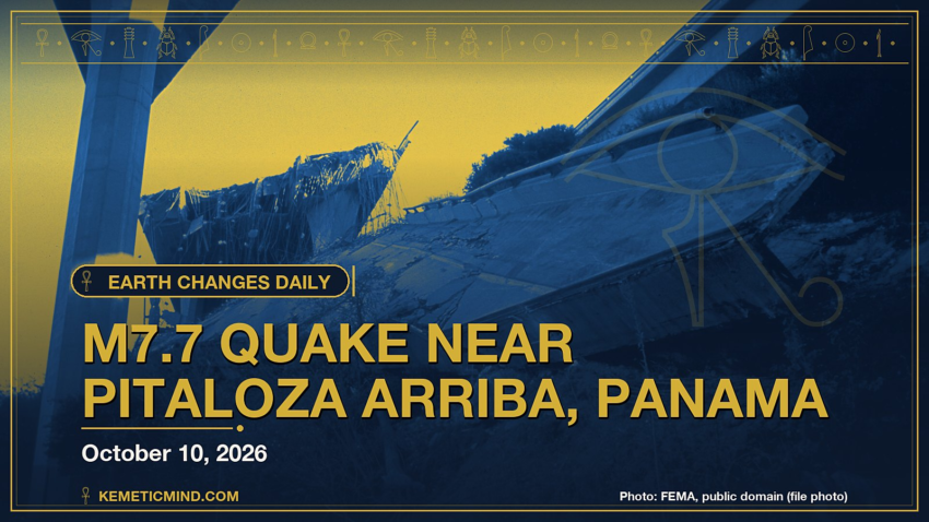
A magnitude 7.7 earthquake struck 12 km WSW of Pitaloza Arriba, Panama at 5:56 p.m. UTC on Oct. 9, about 13 km (≈8 miles) below the surface, the U.S. Geological Survey reports[1]. The USGS PAGER system rates the expected impact RED. It was one of 54 quakes of magnitude 4.5 or greater in the past day.
Meanwhile, Hurricane Simon is churning in the eastern Pacific with top winds near 145 mph and a central pressure of 942 millibars, moving north at 5 mph, according to the National Hurricane Center.[2]
Elsewhere, the National Weather Service has 96 severe or extreme alerts in effect, led by 29 flood watches across AL, AZ, CA, FL and more.[3]
Today at a Glance
- 54 earthquakes of magnitude 4.5 or greater, the largest M7.7
- 3 active tropical systems: Hurricane Simon, Tropical Storm Rachel, Potential Tropical Cyclone Isaias
- 96 severe or extreme U.S. weather alerts
- 4 U.S. volcanoes above normal, including Great Sitkin, Kilauea
- 3 sinkhole reports in the news
Could not be reached for this edition: Smithsonian weekly volcano report.
Where It’s Happening
Numbered pins match the list under the map. Storm and quake pins are the agencies' reported centers; sinkhole pins mark the town named in the report. Map data: OpenStreetMap contributors.
1. Extreme Weather
Tropical storms and hurricanes
- Hurricane Simon (eastern Pacific): top winds near 145 mph, moving north at 5 mph. Latest advisory.[2]
- Tropical Storm Rachel (eastern Pacific): top winds near 60 mph, moving northeast at 22 mph. Latest advisory.[2]
- Potential Tropical Cyclone Isaias (Atlantic): top winds near 35 mph, moving north at 14 mph. Latest advisory.[2]
Across the United States, the National Weather Service has 96 alerts rated severe or extreme in effect.[3]
| Alert | Number | States |
|---|---|---|
| Flood Watch | 29 | AL, AZ, CA, FL, GA, GU and more |
| Flood Warning | 24 | AL, FL, GA, IA, TX |
| Winter Storm Warning | 8 | AK, MT |
| High Wind Warning | 7 | AK, AL, GA, NC, TN, VA |
| Tropical Storm Watch | 5 | CA, PZ |
| Coastal Flood Warning | 4 | CA, SC |
| Freeze Warning | 4 | CA, ME, OR |
| Flash Flood Warning | 3 | GA, SC |
| Red Flag Warning | 3 | CA, MI, NV |
| Freeze Watch | 2 | CA, OR |
The Storm Prediction Center says its highest risk level for severe thunderstorms today is slight, on a scale that runs marginal, slight, enhanced, moderate, high.[4]
Around the world, GDACS, the global disaster alert system run by the United Nations and the European Commission, lists these Orange or Red alerts from the past two days:
- Orange: Orange earthquake (Magnitude 7.7M, Depth:12.647km) in Panama 09/10/2026 17:56 UTC, 590 thousand (in MMI>=VII).[5]
- Orange: Volcanic eruption is on going for Taal in Philippines[6]
Video: NBC News, October 10, 2026 — “Tropical Storm Rachel brings floods to Southern California”. Matched to this report by the storm, volcano or place name in its title.
Video: Associated Press, October 10, 2026 — “Video from Pensacola, Florida shows hotel roof being damaged in Hurricane Isaias”.
2. Earthquakes
The USGS recorded 54 earthquakes of magnitude 4.5 or greater in the past 24 hours.[7] The strongest:
| Mag. | Where | When | Depth | PAGER |
|---|---|---|---|---|
| 7.7 | 12 km WSW of Pitaloza Arriba, Panama | Oct. 9, 5:56 p.m. UTC | 13 km | RED |
| 6.6 | 14 km W of Río Grande, Panama | Oct. 9, 8:25 p.m. UTC | 10 km | YELLOW |
| 6.0 | 7 km N of La Tronosa, Panama | Oct. 10, 4:14 a.m. UTC | 10 km | YELLOW |
| 5.9 | west of Macquarie Island | Oct. 9, 2:49 p.m. UTC | 10 km | GREEN |
| 5.8 | 1 km S of El Cacao, Panama | Oct. 9, 6:37 p.m. UTC | 10 km | YELLOW |
| 5.5 | 3 km SW of Bajo Corral, Panama | Oct. 9, 6:22 p.m. UTC | 10 km | GREEN |
| 5.4 | 9 km SSE of Los Asientos, Panama | Oct. 9, 11:12 p.m. UTC | 10 km | GREEN |
| 5.4 | 99 km NE of Norsup, Vanuatu | Oct. 9, 1:51 p.m. UTC | 10 km | GREEN |
PAGER is the USGS estimate of likely deaths and damage: GREEN means little or none expected, RED means extensive. A dash means none was issued.
Video: NBC News, October 10, 2026 — “Major earthquake shakes Panama”.
3. Volcanoes
In the United States, 4 volcanoes are above normal background activity, according to the U.S. Geological Survey’s observatories:
| Volcano | Alert / aviation code | Latest word from scientists |
|---|---|---|
| Great Sitkin | Watch / Orange | Slow eruption of lava continues within the summit crater associated with low-level seismicity.[8] |
| Kilauea | Watch / Orange | Kīlauea summit north and south vent erupted minor spatter overnight. Kīlauea summit is at a high level of pressurization. Fountaining, intrusions, or an eruption in a new location within the summit region could occur in the coming days to weeks.[9] |
| Ahyi Seamount | Advisory / Yellow | No plumes seen in satellite images; no significant geophysical signals.[10] |
| Shishaldin | Advisory / Yellow | Unrest continues with small earthquakes and tremor, infrasound signals, and gas emissions.[8] |
Alert levels run Normal, Advisory, Watch, Warning. Aviation codes run Green, Yellow, Orange, Red.
4. Sinkholes
No government agency publishes a live national sinkhole feed, so these come from today’s local news:
- Americus Times-Recorder reports, “Weeds grow around Russell Street sinkhole Published 5:45 pm Friday, October 9, 2026”[11]
- Historic Naples District: Il Mattino reports, “Sinkhole Swallows Car in Historic Naples District sabato 10 ottobre 2026, 08:50 – Last updated : 11:45 2 Minutes of Reading The road suddenly gave way and a car with a young man inside was swallowed by the sinkhole.”[12]
- SABC News reports, “The R102 road in the Eastern Cape has been closed to traffic due to a sinkhole, less than a hundred metres west of the Van Stadens Bridge towards Thornhill.”[13]
Also in the News
Other natural-hazard video from the past day, from news organizations:
Video: Al Jazeera English, October 10, 2026 — “Chile declares Las Condes disaster zone after mudslide”. Also in the news. Picked because its title names a natural hazard; it may not be covered in the data above.
Video: FRANCE 24 English, October 10, 2026 — “Trump hails Russia deal to release diesel as midterms loom • FRANCE 24 English”. Also in the news.
5. What the Experts Say
These are the words of the scientists and forecasters who watch these hazards for a living, quoted exactly.
“The very small inner-core of Simon remains very impressive as the cyclone has continued to strengthen. The proxy-visible imagery has started to show that the tiny eye of the hurricane is clearing out. The most recent TAFB Dvorak fix was a T6.0/115 kt, while the objective raw T-number intensity estimates from UW-CIMSS have ranged from 120 to 132 kt. Based on a blend of the objective and subjective intensity estimates, the initial intensity has been increased to 125 kt for this advisory. The wind radii has been adjusted based on a recent ASCAT pass.”
— Forecaster Katz/Roberts, National Hurricane Center, on Hurricane Simon[14]
“Satellite imagery indicates that Rachel's convective organization has changed little over the past several hours, with the deepest convection remaining confined to the northern and northeastern portions of the circulation due to increasing southwesterly vertical wind shear. A 0505 UTC ASCAT-B scatterometer pass revealed peak winds of around 46 kt and an expanding wind field, which helped refine the initial wind radii. Based on these data, the initial intensity is set at 50 kt.”
— Forecaster Gibbs, National Hurricane Center, on Tropical Storm Rachel[15]
“Thunderstorms associated with a tornado threat will be possible today from the eastern Florida Panhandle northeastward into the Carolinas. A few severe wind gusts may also occur in parts of the Desert Southwest.”
— NOAA Storm Prediction Center[4]
“Extensive diversity and complexity of tectonic regimes characterizes the perimeter of the Caribbean plate, involving no fewer than four major plates (North America, South America, Nazca, and Cocos). Inclined zones of deep earthquakes (Wadati-Benioff zones), ocean trenches, and arcs of volcanoes clearly indicate subduction of oceanic lithosphere along the Central American and Atlantic Ocean margins of the Caribbean plate, while crustal seismicity in Guatemala, northern Venezuela, and the Cayman Ridge and Cayman Trench indicate transform fault and pull-apart basin tectonics. Along the northern margin of the Caribbean plate, the North America plate moves westwards with respect to the Caribbean plate at a velocity of approximately 20 mm/yr.”
— U.S. Geological Survey, “Seismotectonics of the Caribbean Region and Vicinity,” on the region around the M7.7 quake[16]
“Cloudy conditions over the past week have limited most satellite and webcam observations. However, satellite data from October 8 show minor continued growth of the southeast lava flow in the summit crater. Seismic activity remains low with occasional small volcanic earthquakes and signals from minor rockfalls caused by lava‑flow growth.”
— Alaska Volcano Observatory, on Great Sitkin[8]
“Both the north and south vents in Halemaʻumaʻu showed strong glow and flames in overnight webcam imagery, with minor amounts of spatter erupted by both vents. Robust plumes of volcanic gas emanate from both vents in day-time webcam views.”
— Hawaiian Volcano Observatory, on Kilauea[9]
“Sinkholes are common where the rock below the land surface is limestone, carbonate rock, salt beds, or other rocks that can naturally be dissolved by groundwater circulating through them. As the rock dissolves, spaces and caverns develop underground. Sinkholes are dramatic because the land usually stays intact for a while until the underground spaces just get too big.”
— U.S. Geological Survey Water Science School, on why sinkholes form[17]
How to Prepare
- Keep a basic kit: water (one gallon per person per day for several days), food, a battery or hand-crank radio, a whistle, a dust mask and phone chargers.[18]
- Get alerts: Wireless Emergency Alerts need no sign-up; the FEMA app, NOAA Weather Radio, the USGS Earthquake Notification Service and the USGS Volcano Notification Service are free.
- Floods: Turn Around, Don’t Drown. Six inches of moving water can knock you down, and one foot can sweep a car away.[19]
- Earthquakes: Drop, Cover and Hold On.[20]
- Download the checklist: Be Ready: Earthquakes, Volcanoes, Extreme Weather and Sinkholes (PDF), with today’s active hazards first.
How to Verify This Yourself
- Earthquakes: USGS Latest Earthquakes map
- U.S. volcanoes: USGS Volcano Hazards Program; world: Smithsonian weekly report
- Weather alerts: weather.gov; tropics: nhc.noaa.gov
- Worldwide disasters: gdacs.org
References
- USGS, M7.7 12 km WSW of Pitaloza Arriba, Panama event page earthquake.usgs.gov. ↩
- National Hurricane Center, active storms data nhc.noaa.gov. ↩
- National Weather Service, active alerts API api.weather.gov. ↩
- NOAA Storm Prediction Center, Day 1 Convective Outlook spc.noaa.gov. ↩
- GDACS event page gdacs.org. ↩
- GDACS event page gdacs.org. ↩
- USGS, M4.5+ earthquakes, past day (real-time feed) earthquake.usgs.gov. ↩
- Alaska Volcano Observatory, Great Sitkin notice volcanoes.usgs.gov. ↩
- Hawaiian Volcano Observatory, Kilauea notice volcanoes.usgs.gov. ↩
- Northern Mariana Islands, Ahyi Seamount notice volcanoes.usgs.gov. ↩
- Americus Times-Recorder, Weeds grow around Russell Street sinkhole americustimesrecorder.com. ↩
- Il Mattino, Sinkhole Swallows Car in Historic Naples District ilmattino.it. ↩
- SABC News, R102 road in EC closed to traffic due to sinkhole sabcnews.com. ↩
- National Hurricane Center, Simon forecast discussion nhc.noaa.gov. ↩
- National Hurricane Center, Rachel forecast discussion nhc.noaa.gov. ↩
- USGS Geoserve, tectonic summary earthquake.usgs.gov. ↩
- USGS Water Science School, Sinkholes usgs.gov. ↩
- Ready.gov (FEMA), Build a Kit ready.gov. ↩
- Ready.gov (FEMA), Floods ready.gov. ↩
- Ready.gov (FEMA), Earthquakes ready.gov. ↩
Methodology: this report is assembled automatically each morning from the live data feeds of the USGS, the Smithsonian Global Volcanism Program, the National Weather Service, the National Hurricane Center, the Storm Prediction Center and GDACS, plus same-day news reports for sinkholes. No AI writes it: the sentences are fixed templates filled with that data, and every quote is copied exactly from the source it is credited to. Data can change after publication; follow the links for the latest.

Kemetic Minds Editorial Desk
Verified NewsroomPrimary-sourced investigative intelligence on civil rights, voting rights, federal policy, and consumer protection. Sourced from primary legal filings, government statistics, and direct field reporting.