Earth Changes · Daily Report · October 8, 2026, 6:30 AM CDT
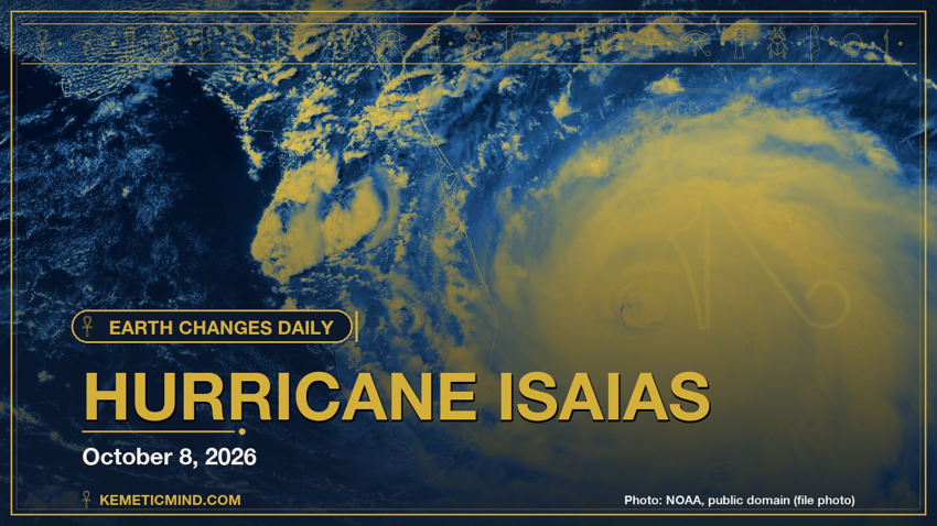
Hurricane Isaias is churning in the Atlantic with top winds near 80 mph and a central pressure of 979 millibars, moving east-northeast at 9 mph, according to the National Hurricane Center.[1] It is one of 3 tropical systems the center is tracking, along with Tropical Storm Rachel and Tropical Storm Simon.
Meanwhile, GDACS, the UN-backed global disaster alert system, issued a Red alert: Red notification for tropical cyclone SIMON-26. Population affected by Category 1 (120 km/h) wind speeds or higher is 0.566 million ..[2]
Elsewhere, the National Weather Service has 182 severe or extreme alerts in effect, led by 21 storm surge warnings across AL, FL, LA, MS.[3]
Today at a Glance
- 17 earthquakes of magnitude 4.5 or greater, the largest M6.3
- 3 active tropical systems: Hurricane Isaias, Tropical Storm Rachel, Tropical Storm Simon
- 182 severe or extreme U.S. weather alerts
- 4 U.S. volcanoes above normal, including Great Sitkin, Kilauea
- 3 sinkhole reports in the news
Could not be reached for this edition: Smithsonian weekly volcano report.
Where It’s Happening
Numbered pins match the list under the map. Storm and quake pins are the agencies' reported centers; sinkhole pins mark the town named in the report. Map data: OpenStreetMap contributors.
1. Extreme Weather
Tropical storms and hurricanes
- Hurricane Isaias (Atlantic): top winds near 80 mph, moving east-northeast at 9 mph. Latest advisory.[1]
- Tropical Storm Rachel (eastern Pacific): top winds near 70 mph, moving west-northwest at 8 mph. Latest advisory.[1]
- Tropical Storm Simon (eastern Pacific): top winds near 50 mph, moving west at 7 mph. Latest advisory.[1]
Across the United States, the National Weather Service has 182 alerts rated severe or extreme in effect.[3]
| Alert | Number | States |
|---|---|---|
| Storm Surge Warning | 21 | AL, FL, LA, MS |
| Hurricane Warning | 18 | AL, FL, GM, MS |
| Hurricane Force Wind Warning | 16 | PK |
| Storm Warning | 36 | PK |
| Tropical Storm Warning | 27 | FL, GM, LA, MS |
| Extreme Heat Warning | 13 | AZ, CA |
| Tropical Storm Watch | 13 | AL, MS |
| Fire Weather Watch | 10 | CA, ID, MT, NE, NV, SD and more |
| Flood Warning | 9 | FL, GA, IA |
| Hurricane Watch | 6 | AL, FL, MS |
Hurricane Warning issued October 8 at 5:33AM CDT by NWS Mobile AL (North Mobile Bay; South Mobile Bay; Mississippi Sound; Perdido Bay Area; Pensacola Bay Area including Santa Rosa Sound; ): “* WHAT…Winds 50 to 70 kt with gusts up to 110 kt and seas 25 to 30 ft. Waves up to 5 ft in bays and sounds. * WHERE…Portions of the coastal waters of Alabama and northwest Florida. * WHEN…Tropical Storm force winds possible from Friday morning until early Saturday morning.”
Hurricane Warning issued October 8 at 5:36AM EDT by NWS Tallahassee FL (St. Andrews Bay Waterways; Coastal waters from Okaloosa-Walton County Line to Mexico Beach out 20 NM; Waters from Okaloo): “* WHAT…Northeast winds 35 to 45 kt with gusts up to 65 kt and seas 13 to 18 ft. * WHERE…St. Andrews Bay Waterways, Coastal waters from Mexico Beach to Okaloosa Walton County Line FL out 20 NM, Waters from Mexico Beach to Okaloosa Walton County Line FL from 20 to 60 NM and Waters from Apalachicola to Mexico Beach FL from 20 to 60 NM. * WHEN…Hurricane force winds possible from Friday morning until early Saturday morning. * IMPACTS…Extremely strong winds will cause hazardous seas which will likely capsize or damage vessels and severely reduce visibility.”
Storm Surge Warning issued October 8 at 4:14AM CDT by NWS Mobile AL (Okaloosa Coastal): “* LOCATIONS AFFECTED – Destin – Eglin AFB – Fort Walton Beach * WIND – LATEST LOCAL FORECAST: Equivalent Tropical Storm force wind – Peak Wind Forecast: 45-55 mph with gusts to 65 mph – Window for Tropical Storm force winds: Friday afternoon until early Saturday morning – THREAT TO LIFE AND PROPERTY THAT INCLUDES TYPICAL FORECAST UNCERTAINTY IN TRACK, SIZE AND INTENSITY: Potential for wind 74 to 110 mph – The wind threat has remained nearly steady from the previous assessment. – PLAN: Plan for life-threatening wind of equivalent CAT 1 or 2 hurricane force. – PREPARE: Remaining efforts to protect life and property should be urgently completed. Prepare for considerable wind damage. – ACT: Move to safe shelter before the wind becomes hazardous. – POTENTIAL IMPACTS: Extensive – Considerable roof damage to sturdy buildings, with some having window, door, and garage door failures leading to structural damage.”
The Storm Prediction Center says no severe thunderstorm areas are forecast today.[4]
Around the world, GDACS, the global disaster alert system run by the United Nations and the European Commission, lists these Orange or Red alerts from the past two days:
- Red: Red notification for tropical cyclone SIMON-26. Population affected by Category 1 (120 km/h) wind speeds or higher is 0.566 million .[2]
- Orange: Orange earthquake (Magnitude 6.3M, Depth:10km) in Vanuatu 08/10/2026 09:00 UTC, 10 thousand (in MMI>=VII).[5]
Video: ABC News, October 8, 2026 — “Isaias strengthens into a hurricane as it continues toward Gulf Coast”. Matched to this report by the storm, volcano or place name in its title.
2. Earthquakes
The USGS recorded 17 earthquakes of magnitude 4.5 or greater in the past 24 hours.[6] The strongest:
| Mag. | Where | When | Depth | PAGER |
|---|---|---|---|---|
| 6.3 | 102 km NE of Norsup, Vanuatu | Oct. 8, 9:00 a.m. UTC | 10 km | GREEN |
| 5.5 | 17 km SW of Burias, Philippines | Oct. 8, 8:07 a.m. UTC | 52 km | GREEN |
| 5.5 | west of Macquarie Island | Oct. 8, 6:46 a.m. UTC | 10 km | GREEN |
| 5.2 | Chagos Archipelago region | Oct. 7, 2:59 p.m. UTC | 10 km | — |
| 5.1 | 236 km E of Levuka, Fiji | Oct. 8, 10:07 a.m. UTC | 602 km | — |
| 5.0 | 92 km N of Ruteng, Indonesia | Oct. 8, 4:48 a.m. UTC | 10 km | — |
| 4.9 | 81 km NNW of Malfa, Italy | Oct. 8, 3:42 a.m. UTC | 367 km | — |
| 4.9 | 13 km SE of Yokoshiba, Japan | Oct. 7, 7:13 p.m. UTC | 51 km | — |
PAGER is the USGS estimate of likely deaths and damage: GREEN means little or none expected, RED means extensive. A dash means none was issued.
3. Volcanoes
In the United States, 4 volcanoes are above normal background activity, according to the U.S. Geological Survey’s observatories:
| Volcano | Alert / aviation code | Latest word from scientists |
|---|---|---|
| Great Sitkin | Watch / Orange | Slow eruption of lava within the summit crater continues.[7] |
| Kilauea | Watch / Orange | Satellite imagery shows the extent of the Sept 30-Oct 1 near surface dike in Kaluapele, the summit caldera of Kīlauea volcano. Recent activity has impacted the ongoing eruption resulting in an update of interpretations and possible outcomes.[8] |
| Ahyi Seamount | Advisory / Yellow | No plumes seen in satellite images; no significant geophysical signals.[9] |
| Shishaldin | Advisory / Yellow | Low-level unrest continues.[7] |
Alert levels run Normal, Advisory, Watch, Warning. Aviation codes run Green, Yellow, Orange, Red.
4. Sinkholes
No government agency publishes a live national sinkhole feed, so these come from today’s local news:
- Bangor, Pennsylvania: WFMZ.com reports, “BANGOR, Pa. – Construction has begun on a road in Northampton County following the opening of a sinkhole earlier this week.”[10]
- The Hindu reports, “A car fell into a sinkhole that suddenly developed after a section of Rajiv Gandhi Salai (IT Expressway) caved in near Tidel Park on Thursday (October 8, 2026).”[11]
- The New Indian Express reports, “ChennaiSinkhole on Chennai’s OMR traps car, occupants escape unhurt Metro rail work is already under way on the stretch.”[12]
Also in the News
Other natural-hazard video from the past day, from news organizations:
Video: NBC News, October 8, 2026 — “Chilean police conduct rescues after severe flooding”. Also in the news. Picked because its title names a natural hazard; it may not be covered in the data above.
Video: Associated Press, October 8, 2026 — “'I hadn't heard about a hurricane,' Trump says on plans to watch Georgia-Alabama game”. Also in the news.
5. What the Experts Say
These are the words of the scientists and forecasters who watch these hazards for a living, quoted exactly.
“Right after the previous advisory, Air Force Reserve hurricane hunter aircraft launched a dropsonde in the southwest quadrant of the storm, finding a 150 m boundary layer average wind of 76 kt, which was the basis for upgrading Isaias to a hurricane at 0330 UTC. Since that time, a NOAA-P3 aircraft has taken over the in-situ sampling of the hurricane, finding that Isaias continues to intensify. The Tail Doppler Radar (TDR) swaths still indicate some northward tilt with height, likely an impact of moderate westerly vertical wind shear that continues to impinge on the circulation, though the circulation is more aligned than in yesterday's mission. The peak TDR winds were up to 80 kt on the 500 m level, and experimental data that reduces the peak TDR winds to the 10 meter level support a maximum sustained wind of 70 kt this advisory.”
— Forecaster Papin, National Hurricane Center, on Hurricane Isaias[13]
“Dry air continues to eat away at Rachel's convection. Satellite imagery over the last couple of hours depicts noticeable degradation across the western semicircle, with deep convection weakening throughout the storm as seen through warming cloud-top temperatures. While TAFB's subjective Dvorak intensity estimate was unchanged at 4.0/65 kt, objective estimates from UW-CIMSS have trended downward. As a result of this, combined with the weakening trend seen through satellite imagery, the initial intensity was set at 60 kt, and Rachel has been downgraded to a Tropical Storm.”
— Forecaster Evans/Roberts, National Hurricane Center, on Tropical Storm Rachel[14]
“Severe thunderstorms are not forecast across the U.S. today or tonight.”
— NOAA Storm Prediction Center[4]
“The eastern margin of the Australia plate is one of the most sesimically active areas of the world due to high rates of convergence between the Australia and Pacific plates. In the region of New Zealand, the 3000 km long Australia-Pacific plate boundary extends from south of Macquarie Island to the southern Kermadec Island chain. It includes an oceanic transform (the Macquarie Ridge), two oppositely verging subduction zones (Puysegur and Hikurangi), and a transpressive continental transform, the Alpine Fault through South Island, New Zealand.”
— U.S. Geological Survey, “Seismotectonics of the Eastern Margin of the Australia Plate,” on the region around the M6.3 quake[15]
“Lava continues to erupt slowly within the summit crater of Great Sitkin Volcano. Minor earthquakes were detected in the past day. No activity was observed in cloudy satellite and webcam images over the past day.”
— Alaska Volcano Observatory, on Great Sitkin[7]
“Recent satellite imagery shows the intrusion of magma that was emplaced on September 30 to October 1, 2026, followed fracture systems created in Kaluapele (Kīlauea’s summit caldera) during the 2018 collapse of Halemaʻumaʻu. This intrusion was emplaced very near the surface north of Halemaʻumaʻu resulting in a narrow band of surface deformation and new, small surface fractures.”
— Hawaiian Volcano Observatory, on Kilauea[8]
“Sinkholes are common where the rock below the land surface is limestone, carbonate rock, salt beds, or other rocks that can naturally be dissolved by groundwater circulating through them. As the rock dissolves, spaces and caverns develop underground. Sinkholes are dramatic because the land usually stays intact for a while until the underground spaces just get too big.”
— U.S. Geological Survey Water Science School, on why sinkholes form[16]
How to Prepare
- Keep a basic kit: water (one gallon per person per day for several days), food, a battery or hand-crank radio, a whistle, a dust mask and phone chargers.[17]
- Get alerts: Wireless Emergency Alerts need no sign-up; the FEMA app, NOAA Weather Radio, the USGS Earthquake Notification Service and the USGS Volcano Notification Service are free.
- Floods: Turn Around, Don’t Drown. Six inches of moving water can knock you down, and one foot can sweep a car away.[18]
- Earthquakes: Drop, Cover and Hold On.[19]
- Download the checklist: Be Ready: Earthquakes, Volcanoes, Extreme Weather and Sinkholes (PDF), with today’s active hazards first.
How to Verify This Yourself
- Earthquakes: USGS Latest Earthquakes map
- U.S. volcanoes: USGS Volcano Hazards Program; world: Smithsonian weekly report
- Weather alerts: weather.gov; tropics: nhc.noaa.gov
- Worldwide disasters: gdacs.org
References
- National Hurricane Center, active storms data nhc.noaa.gov. ↩
- GDACS event page gdacs.org. ↩
- National Weather Service, active alerts API api.weather.gov. ↩
- NOAA Storm Prediction Center, Day 1 Convective Outlook spc.noaa.gov. ↩
- GDACS event page gdacs.org. ↩
- USGS, M4.5+ earthquakes, past day (real-time feed) earthquake.usgs.gov. ↩
- Alaska Volcano Observatory, Great Sitkin notice volcanoes.usgs.gov. ↩
- Hawaiian Volcano Observatory, Kilauea notice volcanoes.usgs.gov. ↩
- Northern Mariana Islands, Ahyi Seamount notice volcanoes.usgs.gov. ↩
- WFMZ.com, Construction begins in Bangor after sinkhole causes road closure wfmz.com. ↩
- The Hindu, Car falls into sinkhole as road caves in near Chennai’s Tidel Park thehindu.com. ↩
- The New Indian Express, Sinkhole on Chennai’s OMR traps car, occupants escape unhurt newindianexpress.com. ↩
- National Hurricane Center, Isaias forecast discussion nhc.noaa.gov. ↩
- National Hurricane Center, Rachel forecast discussion nhc.noaa.gov. ↩
- USGS Geoserve, tectonic summary earthquake.usgs.gov. ↩
- USGS Water Science School, Sinkholes usgs.gov. ↩
- Ready.gov (FEMA), Build a Kit ready.gov. ↩
- Ready.gov (FEMA), Floods ready.gov. ↩
- Ready.gov (FEMA), Earthquakes ready.gov. ↩
Methodology: this report is assembled automatically each morning from the live data feeds of the USGS, the Smithsonian Global Volcanism Program, the National Weather Service, the National Hurricane Center, the Storm Prediction Center and GDACS, plus same-day news reports for sinkholes. No AI writes it: the sentences are fixed templates filled with that data, and every quote is copied exactly from the source it is credited to. Data can change after publication; follow the links for the latest.

Kemetic Minds Editorial Desk
Verified NewsroomPrimary-sourced investigative intelligence on civil rights, voting rights, federal policy, and consumer protection. Sourced from primary legal filings, government statistics, and direct field reporting.