
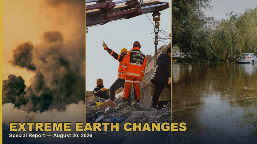
Kemetic Minds — Earth & Survival Series | August 20, 2026
⚠️ Key Findings
- The viral claim checks out: Mount Semeru, Mount Lewotobi Laki-laki, and Mount Ibu erupted within hours of each other on the night of August 18, 2026, confirmed by Indonesia’s own Geological Agency (ESDM)[2].
- That eruption cluster followed — and is on the same island chain as — a magnitude 7.7 earthquake near Flores on August 14 that has killed at least 53 people[1][6].
- The same week brought record flooding to Japan and the U.S. Midwest and a rare close pass of Hurricane Lala by Hawaii’s Big Island[3][4][5].
- Solar activity is elevated but not extreme: NOAA lists roughly a 5% chance of an X-class flare as of August 20[7].
The X Post That Started This
A widely shared post on X claimed Indonesia had “a very active night,” with three separate volcanoes erupting across three regions within hours of each other. We checked it against Indonesia’s own volcano monitoring agency and international earthquake and volcanology databases. The core claim is accurate — with one correction: the third volcano was Mount Ibu in North Maluku, not left unnamed.
The post that started this fact-check: three Indonesian volcanoes erupting within hours of each other.
https://x.com/MrMBB333/status/2090112146055299530
What Actually Erupted, and When
Indonesia’s Geological Agency, under the Ministry of Energy and Mineral Resources (ESDM), recorded three active volcanoes erupting in rapid succession on the night of Tuesday, August 18, 2026, across three separate provinces[2]:
- Mount Semeru (East Java) erupted at 8:33 p.m. local time (WIB). Fog blocked visual confirmation of the ash column, but seismographs recorded a tremor with a maximum amplitude of 22 mm lasting 235 seconds. Semeru remains at Alert Level III, with a 13 km exclusion zone along the Besuk Kobokan river corridor and a 500-meter riverbank buffer extending 17 km downstream[2].
- Mount Lewotobi Laki-laki (East Flores, East Nusa Tenggara) erupted at 9:09 p.m. local time (WITA), sending a gray ash column roughly 300 meters above the summit toward the west and northwest. Seismic amplitude peaked at 11 mm over 109 seconds. Alert Level III[2] [8].
- Mount Ibu (West Halmahera, North Maluku) erupted three separate times that evening — 8:36 p.m., 8:58 p.m., and 11:11 p.m. local time (WIT) — with ash columns reaching 700, 500, and 600 meters respectively. Ibu sits one notch lower on the alert scale, at Level II (Waspada)[2].
All three are established, frequently active volcanoes on Indonesia’s stretch of the Pacific Ring of Fire, not newly “awakening” systems. Lewotobi Laki-laki alone has erupted repeatedly throughout 2026 [8], and the Smithsonian’s Global Volcanism Program currently lists dozens of volcanoes worldwide in ongoing eruption at any given time[9] — simultaneous activity at several Indonesian volcanoes is consistent with a normal, if intense, stretch for the region rather than an unprecedented planetary event.
Figure 1
One Compound Week on Planet Earth (August 11–19, 2026)
Note. Interactive map; hover any marker for details[1][2][3][4][5].
Days Earlier: A Deadly M 7.7 Earthquake on the Same Islands
Four days before the eruptions, at 5:58 a.m. local time on Saturday, August 14, a magnitude 7.7 earthquake struck 68 km north-northwest of Ende on Flores Island, East Nusa Tenggara — the same province as Lewotobi Laki-laki — at a shallow depth of just 10 km[1]. Indonesia’s meteorology agency (BMKG) issued a tsunami warning that was later lifted, and more than 340 aftershocks followed, the strongest a magnitude 6.2.
The confirmed toll has climbed steadily: as of August 16, at least 53 people were dead, 36 seriously injured and 77 more with minor injuries, roughly 5,000 people displaced, more than 1,300 homes damaged, and at least 157 houses destroyed[6]. Rescue crews worked through landslides and broken roads to reach remote villages in Sikka, Manggarai, and East Manggarai regencies. Deputy Health Minister Benjamin Paulus Octavianus confirmed the injury figures directly[6], and residents described the shaking as severe enough that entire households fled outdoors and, in the days after, chose to sleep in tents rather than return inside.
Shallow, high-magnitude earthquakes and nearby volcanic systems both draw on the same underlying plate-boundary stress along the Ring of Fire, but a single M7.7 rupture triggering three separate, geographically distant eruptions four days later is not something seismologists have established as a direct causal chain here — it is more accurately described as one active region of Earth’s crust producing several hazards in quick succession, each documented independently by USGS and Indonesia’s own monitoring agencies.
The Same Week, on the Other Side of the World: Record Floods
While Indonesia absorbed both disasters, two unrelated record-rainfall events were unfolding thousands of miles apart.
In Japan, torrential rain pounded the Chiba and Tokyo area starting August 13, with parts of Chiba Prefecture recording more than 360 mm of rain in 24 hours — roughly three times the normal half-day total for all of August[10]. Japan’s weather agency issued its highest-level heavy rain warning for the region for the first time. At least 8 people died, evacuation orders covered more than 100,000 residents, and 20,000 households lost power[3].
In the United States, days of storms dumped more than 11 inches of rain over three days beginning August 11 across central Indiana. The White River crested at a record 24.9 feet in Anderson, and more than 90 people and their pets were rescued from rising water in Indianapolis. At least seven people died, including an 18-year-old incoming Purdue University freshman who went missing in the Mississinewa River[4].
Figure 2
Confirmed Deaths, Three Simultaneous Disasters (Week of August 11, 2026)
Note. Figures as of August 19–20, 2026 and still provisional in some cases; expect upward revision as search-and-recovery operations continue[6][3][4].
Hurricane Lala’s Rare Close Pass by Hawaii
Hurricane Lala strengthened to a major hurricane in the Central Pacific in mid-August before tracking north and west, passing within roughly 70 miles of Hawaii’s Big Island — only the fifth storm to do so since 1957[5]. It brought widespread flooding, dangerous surf, and damaging winds to multiple islands before weakening as it moved away from the main Hawaiian chain[11] [5].
What About the Sun? Sunspots and Solar Flares, Checked
Extreme-weather threads on social media often fold in solar activity as another sign of planetary upheaval, so we checked that too. The Sun passed its Solar Cycle 25 maximum back in October 2024[12] and is now in its declining phase[13] — still active, but past its peak.
As of August 20, 2026, NOAA forecasters tracked two M-class flares from a newly emerged active region, AR4513: an M1.9 peaking at 8:05 UTC and an M1.0 the day before. A separate, more magnetically complex region, AR4507, retained a “beta-gamma-delta” configuration capable of producing X-class flares, but forecasters put the chance of an actual X-class flare at just 5%[7]. In plain terms: solar activity is elevated and worth watching, but nowhere near an extreme or historically unusual level.
The Bottom Line
Every individual claim in the viral post checks out against primary sources: three Indonesian volcanoes did erupt within hours of each other. What the post left out is the fuller picture — a deadly earthquake on the same islands days earlier, record floods on two other continents, a rare hurricane brush with Hawaii, and solar activity e. That is a genuinely eventful week for planet Earth. It is not evidence of a single unprecedented event but an uptick, and none of the agencies tracking these hazards — USGS, Indonesia’s ESDM, NOAA, or the Global Volcanism Program — have described them as connected.
If you live anywhere near an active fault, volcano, floodplain, or coastline, the practical takeaway does not change based on any of this: keep a 72-hour emergency kit, know your evacuation routes, and follow official alerts from USGS, NOAA, and your local emergency management agency. [14][15].
References
- U.S. Geological Survey. (2026, August 14). M 7.7 — 68 km NNW of Ende, Indonesia. Earthquake Hazards Program. earthquake.usgs.gov ↩a ↩b ↩c
- ANTARA News. (2026, August 19). Three Indonesian volcanoes erupt in rapid succession Tuesday night. Ministry of Energy and Mineral Resources Geological Agency (ESDM). antaranews.com ↩a ↩b ↩c ↩d ↩e ↩f
- CBC News. (2026, August 14). Record rainfall in Japan leaves at least 8 dead, strands travellers. cbc.ca ↩a ↩b ↩c ↩d
- NBC News. (2026, August 16). At least 7 dead from days of heavy rain and record-setting flooding in Indiana. nbcnews.com ↩a ↩b ↩c ↩d
- Newsweek. (2026, August 19). When next hurricane could form as Hawaii recovers from Lala. newsweek.com ↩a ↩b ↩c ↩d
- Al Jazeera Staff, AFP, AP, & Reuters. (2026, August 16). Indonesia’s magnitude 7.7 quake kills at least 53, displaces thousands. aljazeera.com ↩a ↩b ↩c ↩d
- EarthSky. (2026, August 20). Sun news: Solar flare and CME updates. earthsky.org ↩a ↩b
- Global Volcanism Program. (2026). Lewotobi (Indonesia). Smithsonian Institution. volcano.si.edu ↩a ↩b
- Global Volcanism Program. (2026). Current eruptions. Smithsonian Institution. volcano.si.edu ↩
- NPR. (2026, August 14). From Europe to Asia, floods to heatwaves, world experiences weather shocks. npr.org ↩
- National Hurricane Center. (2026, August 19). Hurricane Lala forecast discussion. National Oceanic and Atmospheric Administration. nhc.noaa.gov ↩
- NOAA Space Weather Prediction Center. (2024, October 15). NOAA forecasts quicker, stronger peak of solar activity. spaceweather.gov ↩
- NOAA Space Weather Prediction Center. (2026). Solar cycle progression. spaceweather.gov ↩
- Ready.gov. (2026). Earthquakes. U.S. Department of Homeland Security. ready.gov ↩
- Ready.gov. (2026). Volcanoes. U.S. Department of Homeland Security. ready.gov ↩

Kemetic Minds Editorial Desk
Verified NewsroomPrimary-sourced investigative intelligence on civil rights, voting rights, federal policy, and consumer protection. Sourced from primary legal filings, government statistics, and direct field reporting.