
Earth Changes · Daily Report · November 2, 2026, 11:43 AM CST
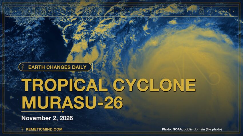
GDACS, the UN-backed global disaster alert system, issued a Red alert: Red notification for tropical cyclone MURASU-26. Population affected by Category 1 (120 km/h) wind speeds or higher is 1.457 million .[1]
Meanwhile, the National Weather Service has 105 severe or extreme alerts in effect, led by 65 flood warnings across AZ, CO, FL, LA and more.[2]
Elsewhere, a magnitude 5.3 earthquake struck 81 km SSE of Palekastro, Greece at 4:49 p.m. UTC on Nov. 2, about 49 km (≈30 miles) below the surface, the U.S. Geological Survey reports[3]. It was one of 22 quakes of magnitude 4.5 or greater in the past day.
Today at a Glance
- 22 earthquakes of magnitude 4.5 or greater, the largest M5.3
- 105 severe or extreme U.S. weather alerts
- 4 U.S. volcanoes above normal, including Great Sitkin
- 3 sinkhole reports in the news
Where It’s Happening
Numbered pins match the list under the map. Storm and quake pins are the agencies' reported centers; sinkhole pins mark the town named in the report. Map data: OpenStreetMap contributors.
1. Extreme Weather
The National Hurricane Center is tracking no active tropical storms.[4]
Across the United States, the National Weather Service has 105 alerts rated severe or extreme in effect.[2]
| Alert | Number | States |
|---|---|---|
| Flood Warning | 65 | AZ, CO, FL, LA, NM, UT |
| Flood Watch | 13 | CO, FL, IA, NM, UT |
| Storm Warning | 10 | PK |
| Flash Flood Warning | 7 | AZ, FL |
| High Wind Warning | 6 | NM, SD, TX |
| Special Marine Warning | 2 | GM |
| Winter Storm Warning | 2 | CO |
The Storm Prediction Center says its highest risk level for severe thunderstorms today is enhanced, on a scale that runs marginal, slight, enhanced, moderate, high.[5]
Around the world, GDACS, the global disaster alert system run by the United Nations and the European Commission, lists these Orange or Red alerts from the past two days:
- Red: Red notification for tropical cyclone MURASU-26. Population affected by Category 1 (120 km/h) wind speeds or higher is 1.457 million .[1]
2. Earthquakes
The USGS recorded 22 earthquakes of magnitude 4.5 or greater in the past 24 hours.[6] The strongest:
| Mag. | Where | When | Depth | PAGER |
|---|---|---|---|---|
| 5.3 | 81 km SSE of Palekastro, Greece | Nov. 2, 4:49 p.m. UTC | 49 km | — |
| 5.1 | 50 km WSW of Huarmey, Peru | Nov. 2, 3:28 p.m. UTC | 67 km | — |
| 5.1 | 19 km WNW of Tomohon, Indonesia | Nov. 2, 8:13 a.m. UTC | 197 km | — |
| 5.1 | Kermadec Islands region | Nov. 2, 1:18 a.m. UTC | 10 km | — |
| 5.1 | Banda Sea | Nov. 2, 12:53 a.m. UTC | 94 km | — |
| 5.0 | Mid-Indian Ridge | Nov. 1, 6:34 p.m. UTC | 10 km | — |
| 4.9 | 175 km WNW of Panguna, Papua New Guinea | Nov. 2, 5:19 a.m. UTC | 88 km | — |
| 4.8 | Mid-Indian Ridge | Nov. 1, 6:53 p.m. UTC | 10 km | — |
PAGER is the USGS estimate of likely deaths and damage: GREEN means little or none expected, RED means extensive. A dash means none was issued.
3. Volcanoes
In the United States, 4 volcanoes are above normal background activity, according to the U.S. Geological Survey’s observatories:
| Volcano | Alert / aviation code | Latest word from scientists |
|---|---|---|
| Great Sitkin | Watch / Orange | Slow eruption of lava within the summit crater continues.[7] |
| Ahyi Seamount | Advisory / Yellow | No signs of unrest in satellite data; no significant geophysical signals.[8] |
| Kilauea | Advisory / Yellow | The Halema'uma'u eruption of Kīlauea remains paused following episode 55 on October 17. The forecast for episode 56 fountaining is Nov. 3-7, 2026.[9] |
| Shishaldin | Advisory / Yellow | Low-level unrest continues.[7] |
Alert levels run Normal, Advisory, Watch, Warning. Aviation codes run Green, Yellow, Orange, Red.
4. Sinkholes
No government agency publishes a live national sinkhole feed, so these come from today’s local news:
- KCRA reports, “Man rescued after falling into sinkhole, truck seen teetering on edge VIDEO:”[10]
- ABC15 Arizona reports, “PHOENIX (KNXV) – Emergency crews rescued a man who fell into a sinkhole that formed in the backyard of his Phoenix home Sunday.”[11]
- Phoenix: Yahoo reports, “Man falls into 6-foot backyard sinkhole in Phoenix, pickup truck partially swallowed The Brief Firefighters and rescue members responded to a man who fell into a backyard sinkhole near 24th Street and Thomas Road.”[12]
Also in the News
Other natural-hazard video from the past day, from news organizations:
Video: Al Jazeera English, November 2, 2026 — “At least seven migrants die on boat bound for Canary Islands amid storm | AJ #shorts”. Also in the news. Picked because its title names a natural hazard; it may not be covered in the data above.
Video: NBC News, November 2, 2026 — “King Charles caught without umbrella in rainstorm”. Also in the news.
5. What the Experts Say
These are the words of the scientists and forecasters who watch these hazards for a living, quoted exactly.
“Severe thunderstorms with damaging wind gusts and a few tornadoes are expected across parts of the southern and central Plains from this afternoon into tonight.”
— NOAA Storm Prediction Center[5]
“The Mediterranean region is seismically active due to the northward convergence (4-10 mm/yr) of the African plate with respect to the Eurasian plate along a complex plate boundary. This convergence began approximately 50 Ma and was associated with the closure of the Tethys Sea. The modern day remnant of the Tethys Sea is the Mediterranean Sea.”
— U.S. Geological Survey, “Seismotectonics of the Mediterranean Region and Vicinity,” on the region around the M5.3 quake[13]
“Lava continues to erupt slowly within the summit crater of Great Sitkin Volcano. A few small earthquakes were detected at the volcano over the last day. Clouds obscured both satellite and webcam views of the volcano.”
— Alaska Volcano Observatory, on Great Sitkin[7]
“Small plumes of discolored water were seen in the ocean above Ahyi on October 16 and 21 this past week. Discolored greenish water was visible drifting several hundred meters from the summit of Ahyi. These plumes are likely associated with degassing and hydrothermal activity at the summit of the underwater volcano.”
— Northern Mariana Islands, on Ahyi Seamount[8]
“Sinkholes are common where the rock below the land surface is limestone, carbonate rock, salt beds, or other rocks that can naturally be dissolved by groundwater circulating through them. As the rock dissolves, spaces and caverns develop underground. Sinkholes are dramatic because the land usually stays intact for a while until the underground spaces just get too big.”
— U.S. Geological Survey Water Science School, on why sinkholes form[14]
How to Prepare
- Keep a basic kit: water (one gallon per person per day for several days), food, a battery or hand-crank radio, a whistle, a dust mask and phone chargers.[15]
- Get alerts: Wireless Emergency Alerts need no sign-up; the FEMA app, NOAA Weather Radio, the USGS Earthquake Notification Service and the USGS Volcano Notification Service are free.
- Floods: Turn Around, Don’t Drown. Six inches of moving water can knock you down, and one foot can sweep a car away.[16]
- Earthquakes: Drop, Cover and Hold On.[17]
- Download the checklist: Be Ready: Earthquakes, Volcanoes, Extreme Weather and Sinkholes (PDF), with today’s active hazards first.
How to Verify This Yourself
- Earthquakes: USGS Latest Earthquakes map
- U.S. volcanoes: USGS Volcano Hazards Program; world: Smithsonian weekly report
- Weather alerts: weather.gov/alerts; tropics: nhc.noaa.gov
- Worldwide disasters: gdacs.org
References
- GDACS event page gdacs.org. ↩
- National Weather Service, active alerts API api.weather.gov. ↩
- USGS, M5.3 81 km SSE of Palekastro, Greece event page earthquake.usgs.gov. ↩
- National Hurricane Center, active storms data nhc.noaa.gov. ↩
- NOAA Storm Prediction Center, Day 1 Convective Outlook spc.noaa.gov. ↩
- USGS, M4.5+ earthquakes, past day (real-time feed) earthquake.usgs.gov. ↩
- Alaska Volcano Observatory, Great Sitkin notice volcanoes.usgs.gov. ↩
- Northern Mariana Islands, Ahyi Seamount notice volcanoes.usgs.gov. ↩
- Hawaiian Volcano Observatory, Kilauea notice volcanoes.usgs.gov. ↩
- KCRA, VIDEO: Man rescued after falling into sinkhole, truck seen teetering on edge kcra.com. ↩
- ABC15 Arizona, Emergency crews rescue man who fell down sinkhole in Phoenix backyard abc15.com. ↩
- Yahoo, Man falls into 6-foot backyard sinkhole in Phoenix, pickup truck partially swallowed yahoo.com. ↩
- USGS Geoserve, tectonic summary earthquake.usgs.gov. ↩
- USGS Water Science School, Sinkholes usgs.gov. ↩
- Ready.gov (FEMA), Build a Kit ready.gov. ↩
- Ready.gov (FEMA), Floods ready.gov. ↩
- Ready.gov (FEMA), Earthquakes ready.gov. ↩
Methodology: this report is assembled automatically each morning from the live data feeds of the USGS, the Smithsonian Global Volcanism Program, the National Weather Service, the National Hurricane Center, the Storm Prediction Center and GDACS, plus same-day news reports for sinkholes. No AI writes it: the sentences are fixed templates filled with that data, and every quote is copied exactly from the source it is credited to. Data can change after publication; follow the links for the latest.

Kemetic Minds Editorial Desk
Verified NewsroomPrimary-sourced investigative intelligence on civil rights, voting rights, federal policy, and consumer protection. Sourced from primary legal filings, government statistics, and direct field reporting.