
Earth Changes · Daily Report · October 9, 2026, 6:30 AM CDT
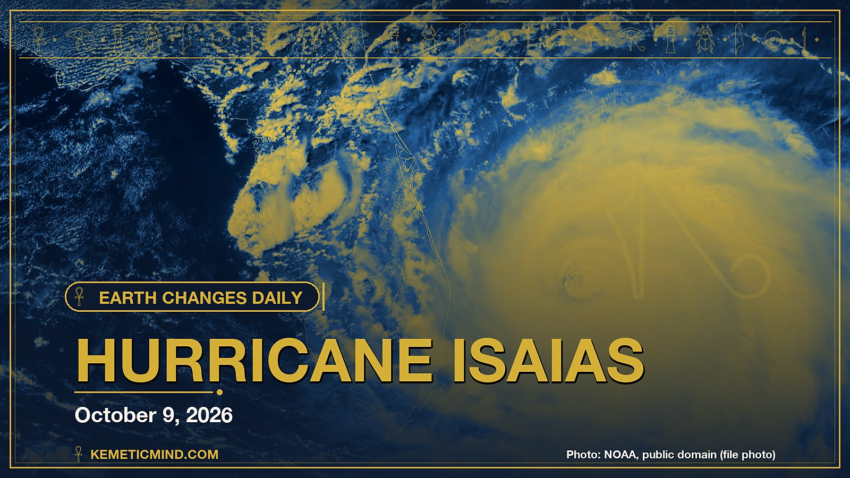
Hurricane Isaias is churning in the Atlantic with top winds near 110 mph and a central pressure of 963 millibars, moving north-northeast at 15 mph, according to the National Hurricane Center.[1] It is one of 3 tropical systems the center is tracking, along with Hurricane Simon and Tropical Storm Rachel.
Meanwhile, GDACS, the UN-backed global disaster alert system, issued a Red alert: Red notification for tropical cyclone SIMON-26. Population affected by Category 1 (120 km/h) wind speeds or higher is 0.476 million ..[2]
Elsewhere, the National Weather Service has 237 severe or extreme alerts in effect, led by 23 hurricane warnings across AL, FL, GM, MS.[3]
Today at a Glance
- 12 earthquakes of magnitude 4.5 or greater, the largest M5.2
- 3 active tropical systems: Hurricane Isaias, Hurricane Simon, Tropical Storm Rachel
- 237 severe or extreme U.S. weather alerts
- 4 U.S. volcanoes above normal, including Great Sitkin, Kilauea
- 3 sinkhole reports in the news
Could not be reached for this edition: Smithsonian weekly volcano report, USGS sinkhole explainer.
Where It’s Happening
Numbered pins match the list under the map. Storm and quake pins are the agencies' reported centers; sinkhole pins mark the town named in the report. Map data: OpenStreetMap contributors.
1. Extreme Weather
Tropical storms and hurricanes
- Hurricane Isaias (Atlantic): top winds near 110 mph, moving north-northeast at 15 mph. Latest advisory.[1]
- Hurricane Simon (eastern Pacific): top winds near 90 mph, moving northwest at 5 mph. Latest advisory.[1]
- Tropical Storm Rachel (eastern Pacific): top winds near 50 mph, moving northeast at 3 mph. Latest advisory.[1]
Across the United States, the National Weather Service has 237 alerts rated severe or extreme in effect.[3]
| Alert | Number | States |
|---|---|---|
| Hurricane Warning | 23 | AL, FL, GM, MS |
| Storm Surge Warning | 22 | AL, FL, LA, MS |
| Tropical Storm Watch | 65 | AL, FL, GA, MS |
| Tropical Storm Warning | 55 | AL, FL, GA, GM, LA, MS |
| Flood Warning | 18 | AL, FL, GA, IA |
| Flood Watch | 15 | AL, FL, GA, MS, NC, TN |
| Red Flag Warning | 12 | CA, ID, LA, MT, NE, NV and more |
| Winter Storm Watch | 6 | MT |
| High Wind Watch | 5 | AL, GA, NC, TN |
| Extreme Heat Warning | 4 | AZ, CA |
Hurricane Warning issued October 9 at 4:28AM CDT by NWS New Orleans LA (Mississippi Sound; Breton Sound; Chandeleur Sound; Coastal Waters from Boothville LA to Southwest Pass of the Mississipp): “* WHAT…Northeast winds 25 to 35 kt with gusts up to 70 kt and seas 16 to 21 ft. * WHERE…Portions of Gulf of America. * WHEN…Tropical Storm force winds possible until late this afternoon. * IMPACTS…Hurricane force winds and hazardous seas will capsize or damage vessels and severely reduce visibility.”
Storm Surge Warning issued October 9 at 5:17AM EDT by NWS Tallahassee FL (Coastal Gulf): “* LOCATIONS AFFECTED – Port Saint Joe – Cape San Blas * WIND – LATEST LOCAL FORECAST: Equivalent Tropical Storm force wind – Peak Wind Forecast: 35-45 mph with gusts to 60 mph – Window for Tropical Storm force winds: early this afternoon until early Saturday morning – THREAT TO LIFE AND PROPERTY THAT INCLUDES TYPICAL FORECAST UNCERTAINTY IN TRACK, SIZE AND INTENSITY: Potential for wind 58 to 73 mph – The wind threat has increased from the previous assessment. – PLAN: Plan for dangerous wind of equivalent strong tropical storm force. – PREPARE: Remaining efforts to protect life and property should be completed as soon as possible. Prepare for significant wind damage. – ACT: Move to safe shelter before the wind becomes hazardous. – POTENTIAL IMPACTS: Significant – Some damage to roofing and siding materials, along with damage to porches, awnings, carports, and sheds.”
Storm Surge Warning issued October 9 at 5:17AM EDT by NWS Tallahassee FL (Coastal Wakulla): “* LOCATIONS AFFECTED – Saint Marks – Panacea * WIND – LATEST LOCAL FORECAST: Below tropical storm force wind – Peak Wind Forecast: 10-20 mph with gusts to 40 mph – THREAT TO LIFE AND PROPERTY THAT INCLUDES TYPICAL FORECAST UNCERTAINTY IN TRACK, SIZE AND INTENSITY: Potential for wind 39 to 57 mph – The wind threat has remained nearly steady from the previous assessment. – PLAN: The sustained wind should remain less than tropical storm force. Conditions may still be gusty. – PREPARE: Listen for any instructions from local officials. – ACT: Ensure emergency readiness should the forecast change. – REALIZED IMPACTS: Being Assessed – Little to no additional wind impacts expected.”
The Storm Prediction Center says its highest risk level for severe thunderstorms today is slight, on a scale that runs marginal, slight, enhanced, moderate, high.[4]
Around the world, GDACS, the global disaster alert system run by the United Nations and the European Commission, lists these Orange or Red alerts from the past two days:
- Red: Red notification for tropical cyclone SIMON-26. Population affected by Category 1 (120 km/h) wind speeds or higher is 0.476 million .[2]
- Orange: Orange earthquake (Magnitude 6.3M, Depth:10km) in Vanuatu 08/10/2026 09:00 UTC, 10 thousand (in MMI>=VII).[5]
- Orange: Volcanic eruption is on going for Taal in Philippines[6]
Video: ABC News, October 9, 2026 — “Hurricane Isaias strengthens to a Category 2 storm”. Matched to this report by the storm, volcano or place name in its title.
Video: AccuWeather, October 8, 2026 — “Hurricane Isaias and Rachel: A Rare Double U.S. Impact”.
2. Earthquakes
The USGS recorded 12 earthquakes of magnitude 4.5 or greater in the past 24 hours.[7] The strongest:
| Mag. | Where | When | Depth | PAGER |
|---|---|---|---|---|
| 5.2 | 117 km SE of Bitung, Indonesia | Oct. 9, 5:11 a.m. UTC | 40 km | — |
| 5.1 | 72 km SSW of Colchane, Chile | Oct. 9, 10:22 a.m. UTC | 124 km | — |
| 4.9 | 77 km ENE of Tuapejat, Indonesia | Oct. 9, 9:47 a.m. UTC | 41 km | — |
| 4.9 | south of the Fiji Islands | Oct. 9, 5:17 a.m. UTC | 130 km | — |
| 4.9 | 113 km NW of Baa, Indonesia | Oct. 8, 2:11 p.m. UTC | 10 km | — |
| 4.8 | northern Mid-Atlantic Ridge | Oct. 9, 9:29 a.m. UTC | 10 km | — |
| 4.8 | 97 km E of Levuka, Fiji | Oct. 9, 8:27 a.m. UTC | 640 km | — |
| 4.8 | 46 km N of Waingapu, Indonesia | Oct. 8, 6:06 p.m. UTC | 91 km | — |
PAGER is the USGS estimate of likely deaths and damage: GREEN means little or none expected, RED means extensive. A dash means none was issued.
3. Volcanoes
In the United States, 4 volcanoes are above normal background activity, according to the U.S. Geological Survey’s observatories:
| Volcano | Alert / aviation code | Latest word from scientists |
|---|---|---|
| Great Sitkin | Watch / Orange | Slow eruption of lava within the summit crater continues.[8] |
| Kilauea | Watch / Orange | Kīlauea summit north vent erupted minor spatter overnight. Kīlauea summit is at a high level of pressurization. Fountaining, intrusions, or an eruption in a new location within the summit region could occur.[9] |
| Ahyi Seamount | Advisory / Yellow | No plumes seen in satellite images; no significant geophysical signals.[10] |
| Shishaldin | Advisory / Yellow | Low-level unrest continues.[8] |
Alert levels run Normal, Advisory, Watch, Warning. Aviation codes run Green, Yellow, Orange, Red.
4. Sinkholes
No government agency publishes a live national sinkhole feed, so these come from today’s local news:
- Santa Fe New Mexican reports, “A sinkhole believed to be caused by a water main break was discovered after it swallowed the front end of a vehicle on the south side of Santa Fe early Thursday morning.”[11]
- WINK News reports, “A sinkhole has forced the closure of Crayton Road in Naples, according to the Naples Police Department.”[12]
- Naples: Gulf Coast News and Weather reports, “Car swallowed by sinkhole on Crayton Road and towed in Naples Advertisement Digital Content Producer Car swallowed by sinkhole on Crayton Road and towed in Naples Digital Content Producer A sinkhole swallowed a car on Crayton Road in Naples on Thursday.”[13]
Also in the News
Other natural-hazard video from the past day, from news organizations:
Video: Associated Press, October 9, 2026 — “Heavy rain triggers flooding in Chile’s Santiago, sweeping away vehicles”. Also in the news. Picked because its title names a natural hazard; it may not be covered in the data above.
5. What the Experts Say
These are the words of the scientists and forecasters who watch these hazards for a living, quoted exactly.
“Isaias has intensified overnight. NOAA and Air Force Reserve Hurricane Hunter data showed that the maximum flight-level winds have increased up to 107 kt, with a better-defined eye and a shrinking eyewall. These changes are also present on satellite imagery, with a more symmetric presentation along with a warming eye/cooling eyewall. The available data suggest a current intensity of 95 kt for this advisory.”
— Forecaster Blake, National Hurricane Center, on Hurricane Isaias[14]
“Simon has quickly strengthened this morning. A EUMETSAT METOP-B Microwave Humidity Sounder (MHS) image revealed a small banding eye feature, and the IR-BD curve enhancement indicates -83C cold cloud tops associated with a small central dense overcast over the surface center. Water vapor imagery and satellite wind data indicate developing cyclonic outflow above 200 mb. Based on the much improved cloud pattern and the TAFB subjective intensity estimate of T4.5 (77 kt), the initial intensity is increased to 80 kt.”
— Forecaster Roberts, National Hurricane Center, on Hurricane Simon[15]
“Thunderstorms associated with Hurricane Isaias will have potential to produce tornadoes from this afternoon into the overnight period from the Florida Panhandle into southeast Alabama and southwest Georgia.”
— NOAA Storm Prediction Center[4]
“The Australia-Pacific plate boundary is over 4000 km long on the northern margin, from the Sunda (Java) trench in the west to the Solomon Islands in the east. The eastern section is over 2300 km long, extending west from northeast of the Australian continent and the Coral Sea until it intersects the east coast of Papua New Guinea. The boundary is dominated by the general northward subduction of the Australia plate.”
— U.S. Geological Survey, “Seismotectonics of the New Guinea Region and Vicinity,” on the region around the M5.2 quake[16]
“Lava continues to erupt slowly within the summit crater of Great Sitkin Volcano. Minor earthquakes were detected in the past day. Elevated surface temperatures were observed in satellite data.”
— Alaska Volcano Observatory, on Great Sitkin[8]
“Both the north and south vents in Halemaʻumaʻu showed strong glow and flames in overnight webcam imagery, with minor amounts of spatter erupted by the north vent. Robust plumes of volcanic gas emanate from both vents in day-time webcam views.”
— Hawaiian Volcano Observatory, on Kilauea[9]
How to Prepare
- Keep a basic kit: water (one gallon per person per day for several days), food, a battery or hand-crank radio, a whistle, a dust mask and phone chargers.[17]
- Get alerts: Wireless Emergency Alerts need no sign-up; the FEMA app, NOAA Weather Radio, the USGS Earthquake Notification Service and the USGS Volcano Notification Service are free.
- Floods: Turn Around, Don’t Drown. Six inches of moving water can knock you down, and one foot can sweep a car away.[18]
- Earthquakes: Drop, Cover and Hold On.[19]
- Download the checklist: Be Ready: Earthquakes, Volcanoes, Extreme Weather and Sinkholes (PDF), with today’s active hazards first.
How to Verify This Yourself
- Earthquakes: USGS Latest Earthquakes map
- U.S. volcanoes: USGS Volcano Hazards Program; world: Smithsonian weekly report
- Weather alerts: weather.gov; tropics: nhc.noaa.gov
- Worldwide disasters: gdacs.org
References
- National Hurricane Center, active storms data nhc.noaa.gov. ↩
- GDACS event page gdacs.org. ↩
- National Weather Service, active alerts API api.weather.gov. ↩
- NOAA Storm Prediction Center, Day 1 Convective Outlook spc.noaa.gov. ↩
- GDACS event page gdacs.org. ↩
- GDACS event page gdacs.org. ↩
- USGS, M4.5+ earthquakes, past day (real-time feed) earthquake.usgs.gov. ↩
- Alaska Volcano Observatory, Great Sitkin notice volcanoes.usgs.gov. ↩
- Hawaiian Volcano Observatory, Kilauea notice volcanoes.usgs.gov. ↩
- Northern Mariana Islands, Ahyi Seamount notice volcanoes.usgs.gov. ↩
- Santa Fe New Mexican, Jaguar Drive sinkhole leads to crash, road closure on Santa Fe's south side santafenewmexican.com. ↩
- WINK News, Sinkhole shuts down Crayton Road in Naples between Parkview and Binnacle drives: police winknews.com. ↩
- Gulf Coast News and Weather, Car swallowed by sinkhole on Crayton Road and towed in Naples gulfcoastnewsnow.com. ↩
- National Hurricane Center, Isaias forecast discussion nhc.noaa.gov. ↩
- National Hurricane Center, Simon forecast discussion nhc.noaa.gov. ↩
- USGS Geoserve, tectonic summary earthquake.usgs.gov. ↩
- Ready.gov (FEMA), Build a Kit ready.gov. ↩
- Ready.gov (FEMA), Floods ready.gov. ↩
- Ready.gov (FEMA), Earthquakes ready.gov. ↩
Methodology: this report is assembled automatically each morning from the live data feeds of the USGS, the Smithsonian Global Volcanism Program, the National Weather Service, the National Hurricane Center, the Storm Prediction Center and GDACS, plus same-day news reports for sinkholes. No AI writes it: the sentences are fixed templates filled with that data, and every quote is copied exactly from the source it is credited to. Data can change after publication; follow the links for the latest.

Kemetic Minds Editorial Desk
Verified NewsroomPrimary-sourced investigative intelligence on civil rights, voting rights, federal policy, and consumer protection. Sourced from primary legal filings, government statistics, and direct field reporting.